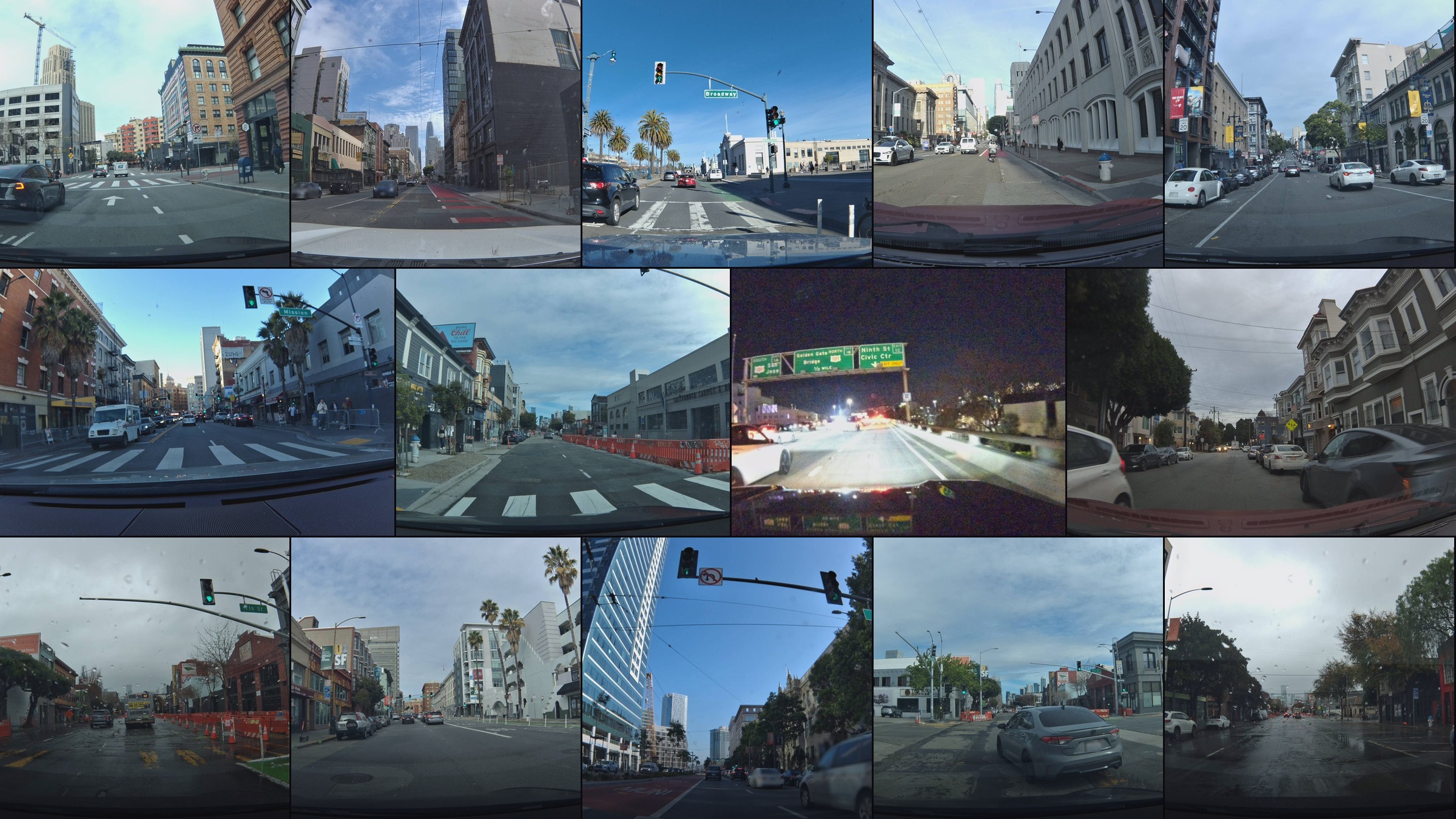
You remember almost nothing.
Ten minutes through SoMa on a Saturday morning — and if someone asked you to describe the route, you'd give them maybe three facts. "Some construction. A couple of lights. I think I followed a Tesla for a while."
The Bee mounted to your windshield remembers everything. 100 road features. 18 speed signs. 36 turn restrictions. 11 fire hydrants. 15 highway signs. 3 stop signs. 17 parking restrictions. 247 dashcam frames tied to those features — each one tagged with GPS, heading, accelerometer, and gyroscope data.
You weren't paying attention. It was.
11:21 AM
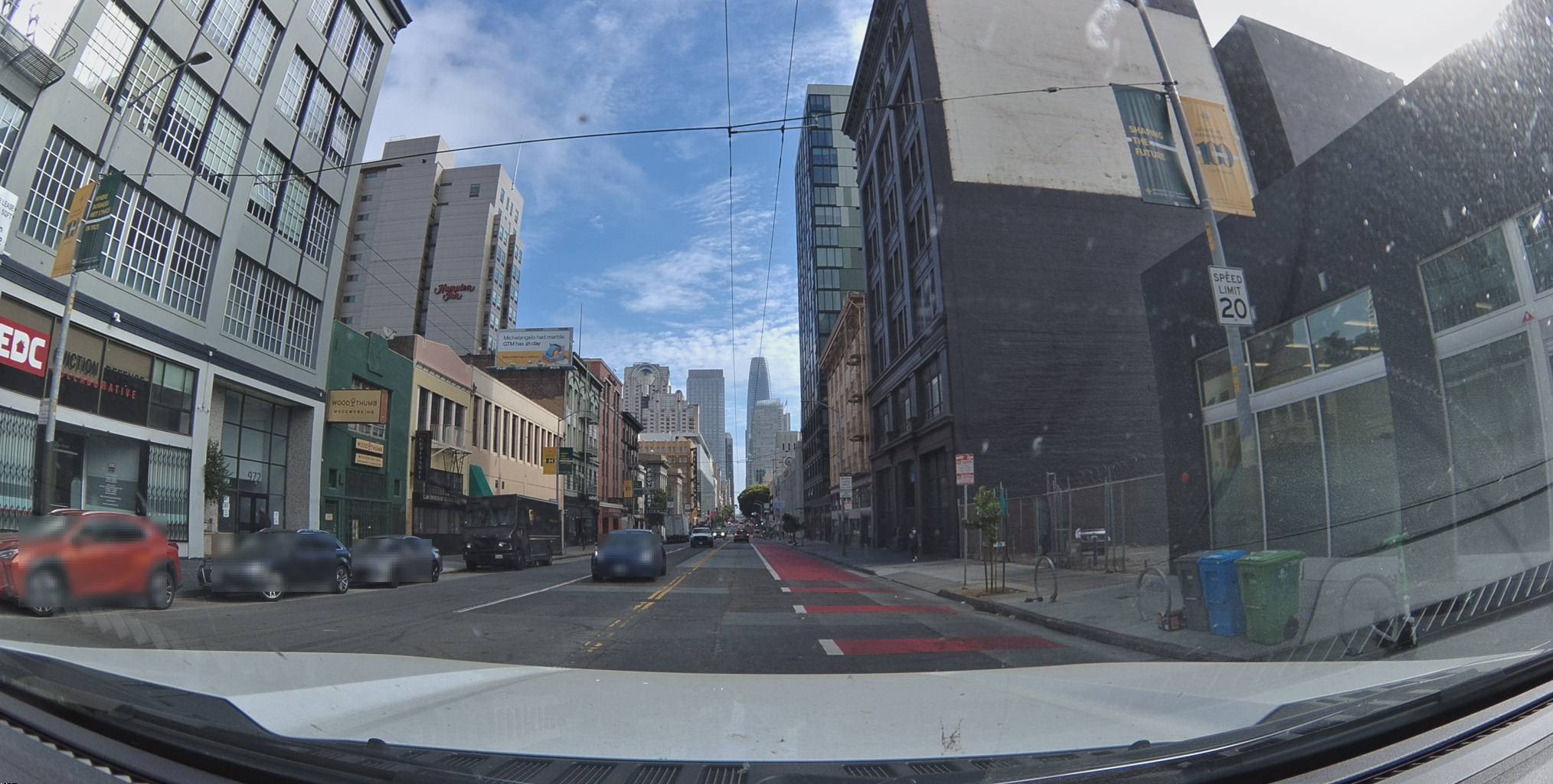
The drive begins near Townsend Street. Overcast. Light traffic. Unremarkable.
Metadata
Try this API query
curl -X POST https://beemaps.com/api/developer/imagery/latest/poly \
-H "Authorization: Basic <your-api-key>" \
-H "Content-Type: application/json" \
-d '{
"polygon": [
[-122.4111, 37.7741],
[-122.4091, 37.7741],
[-122.4091, 37.7761],
[-122.4111, 37.7761],
[-122.4111, 37.7741]
]
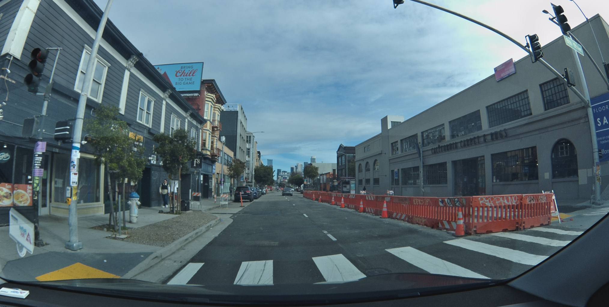
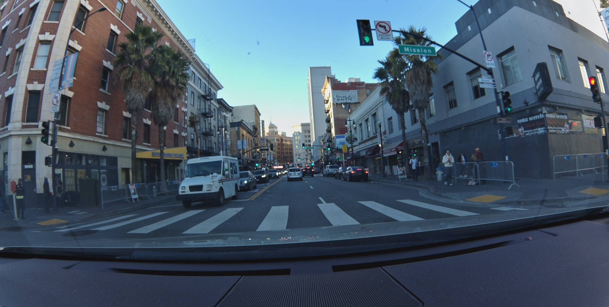
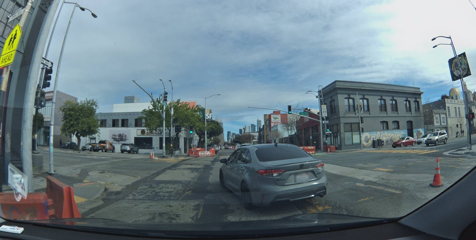
}'Here is what you see: a road. Orange barriers. Parked cars. You are already thinking about where you're going.
Here is what the Bee sees: a fire hydrant at the curb, confirmed by 7 previous passes. A construction zone narrowing the lane. Bike lane markings. Crosswalk striping. A street name sign it will cross-reference against its GPS position.
View metadata
Try this API query
curl -X POST "https://beemaps.com/api/developer/map-data?apiKey=<your-api-key>" \
  -H "Content-Type: application/json" \
  -d '{
    "type": ["mapFeatures"],
    "geometry": {
      "type": "Polygon",
      "coordinates": [[
        [-122.4082, 37.7811],
        [-122.4062, 37.7811],
        [-122.4062, 37.7831],
        [-122.4082, 37.7831],
        [-122.4082, 37.7811]
      ]]
    }
  }'
You haven't thought about where to turn yet. The Bee has already catalogued this intersection.
18 Signs That Say Slow Down
Eighteen speed signs in a 10-minute corridor. Not all from this single drive — across every pass through this area, the Bee has identified and tracked every posted speed limit.
The numbers tell you something about this city. Six signs at 20 mph. Twelve at 25 mph. No 30. No 35. San Francisco is not asking you to slow down. It's telling you.
Metadata
Try this API query
curl -X POST https://beemaps.com/api/developer/imagery/latest/poly \
  -H "Authorization: Basic <your-api-key>" \
  -H "Content-Type: application/json" \
  -d '{
    "polygon": [
      [-122.4150, 37.7812],
      [-122.4130, 37.7812],
      [-122.4130, 37.7832],
      [-122.4150, 37.7832],
      [-122.4150, 37.7812]
    ]
  }'
This frame near UC Hastings College of the Law. Two 20 mph signs — one on each side of the street. You might register them peripherally. The Bee reads both. Records both. Adds them to a growing database of confirmed speed limits for this corridor.
View metadata
Try this API query
curl -X POST "https://beemaps.com/api/developer/map-data?apiKey=<your-api-key>" \
  -H "Content-Type: application/json" \
  -d '{
    "type": ["mapFeatures"],
    "geometry": {
      "type": "Polygon",
      "coordinates": [[
        [-122.4091, 37.7804],
        [-122.4071, 37.7804],
        [-122.4071, 37.7824],
        [-122.4091, 37.7824],
        [-122.4091, 37.7804]
      ]]
    }
  }'
This sign has been independently confirmed 13 times by different Bee devices. Its companion down the block — 25 mph — has been confirmed 32 times over 13 months. Confidence score: 1.0.
View metadata
Try this API query
curl -X POST "https://beemaps.com/api/developer/map-data?apiKey=<your-api-key>" \
  -H "Content-Type: application/json" \
  -d '{
    "type": ["mapFeatures"],
    "geometry": {
      "type": "Polygon",
      "coordinates": [[
        [-122.4097, 37.7752],
        [-122.4077, 37.7752],
        [-122.4077, 37.7772],
        [-122.4097, 37.7772],
        [-122.4097, 37.7752]
      ]]
    }
  }'
And then there's the school zone. 25 mph — but classified as type: "school", meaning the limit activates during school hours. Confirmed 20 times since November 2023. That distinction — school zone vs. regulatory, time-dependent vs. permanent — is metadata the Bee reads from the sign itself. Not from a database. From the sign.
View metadata
Try this API query
curl -X POST "https://beemaps.com/api/developer/map-data?apiKey=<your-api-key>" \
  -H "Content-Type: application/json" \
  -d '{
    "type": ["mapFeatures"],
    "geometry": {
      "type": "Polygon",
      "coordinates": [[
        [-122.4087, 37.7758],
        [-122.4067, 37.7758],
        [-122.4067, 37.7778],
        [-122.4087, 37.7778],
        [-122.4087, 37.7758]
      ]]
    }
  }'
36 Ways You Can't Turn
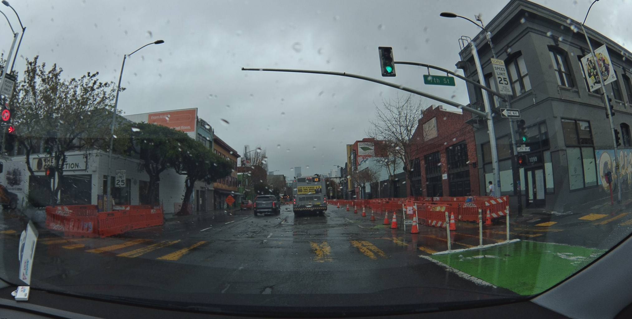
Thirty-six turn restriction signs. In one corridor.
You process turn restrictions the way everyone does: you approach the intersection, you see the sign, you don't turn. Reactive. One at a time. The Bee processes them the other way — proactively, building a complete map of every restriction across every pass.
Metadata
Try this API query
curl -X POST https://beemaps.com/api/developer/imagery/latest/poly \
-H "Authorization: Basic <your-api-key>" \
-H "Content-Type: application/json" \
-d '{
"polygon": [
[-122.4132, 37.7793],
[-122.4112, 37.7793],
[-122.4112, 37.7813],
[-122.4132, 37.7813],
[-122.4132, 37.7793]
]
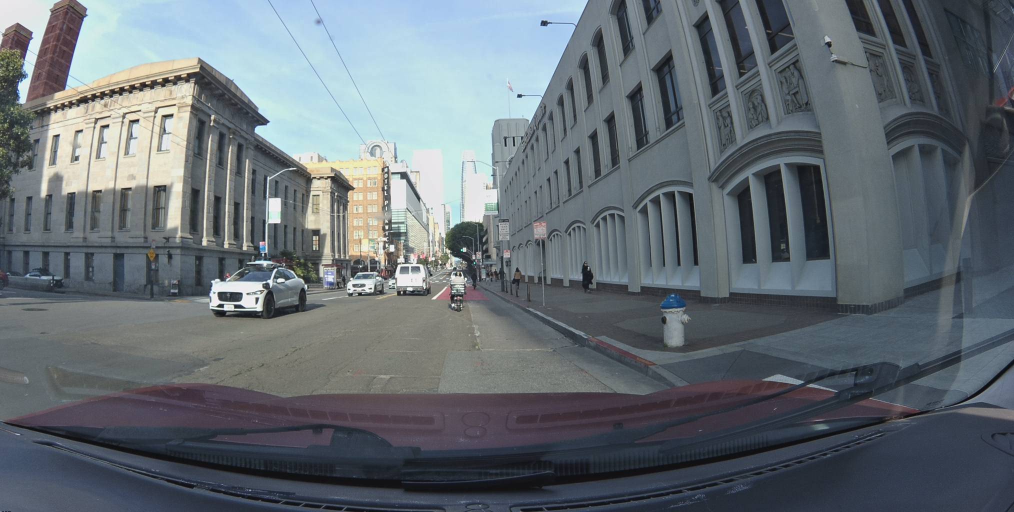
}'Look at this frame near Civic Center. A no-right-turn sign on the right. A "LEFT LANE ONLY AHEAD" sign on the left. Directional arrows painted on the road. A pedestrian mid-crosswalk. You're watching the Tesla's brake lights. The Bee is reading every sign in the frame.
| Turn Rule | Count |
|---|---|
| No right turn | 17 |
| No left turn | 15 |
| No U-turn + no left turn (compound) | 4 |
The most-confirmed turn restriction — a no-right-turn sign — has been independently detected 34 times. Thirty-four different Bee devices. Fourteen months. Each one confirming: the sign still exists, still says the same thing, still stands in the same position. That's not a database entry. That's a consensus.
View metadata
Try this API query
curl -X POST "https://beemaps.com/api/developer/map-data?apiKey=<your-api-key>" \
  -H "Content-Type: application/json" \
  -d '{
    "type": ["mapFeatures"],
    "geometry": {
      "type": "Polygon",
      "coordinates": [[
        [-122.4098, 37.7801],
        [-122.4078, 37.7801],
        [-122.4078, 37.7821],
        [-122.4098, 37.7821],
        [-122.4098, 37.7801]
      ]]
    }
  }'
The compound restrictions are the ones that matter most. A single physical sign that says both "no U-turn" and "no left turn" — two rules encoded on one piece of metal. The Bee reads both. Stores each as structured data: turnRules: "no_u_turn_no_left_turn". Navigation apps that rely on turn-by-turn databases sometimes miss compound restrictions entirely. They encode the U-turn but not the left turn. Or vice versa. The Bee doesn't miss.
View metadata
Try this API query
curl -X POST "https://beemaps.com/api/developer/map-data?apiKey=<your-api-key>" \
  -H "Content-Type: application/json" \
  -d '{
    "type": ["mapFeatures"],
    "geometry": {
      "type": "Polygon",
      "coordinates": [[
        [-122.4207, 37.7762],
        [-122.4187, 37.7762],
        [-122.4187, 37.7782],
        [-122.4207, 37.7782],
        [-122.4207, 37.7762]
      ]]
    }
  }'
The Layer You Trained Yourself to Ignore
Beyond the signs that tell you what to do, there is an entire infrastructure you have learned not to see. Fire hydrants. Parking restrictions. Stop signs. The machinery of a city, hiding in plain sight.
Map Every Detail
Metadata
Try this API query
154
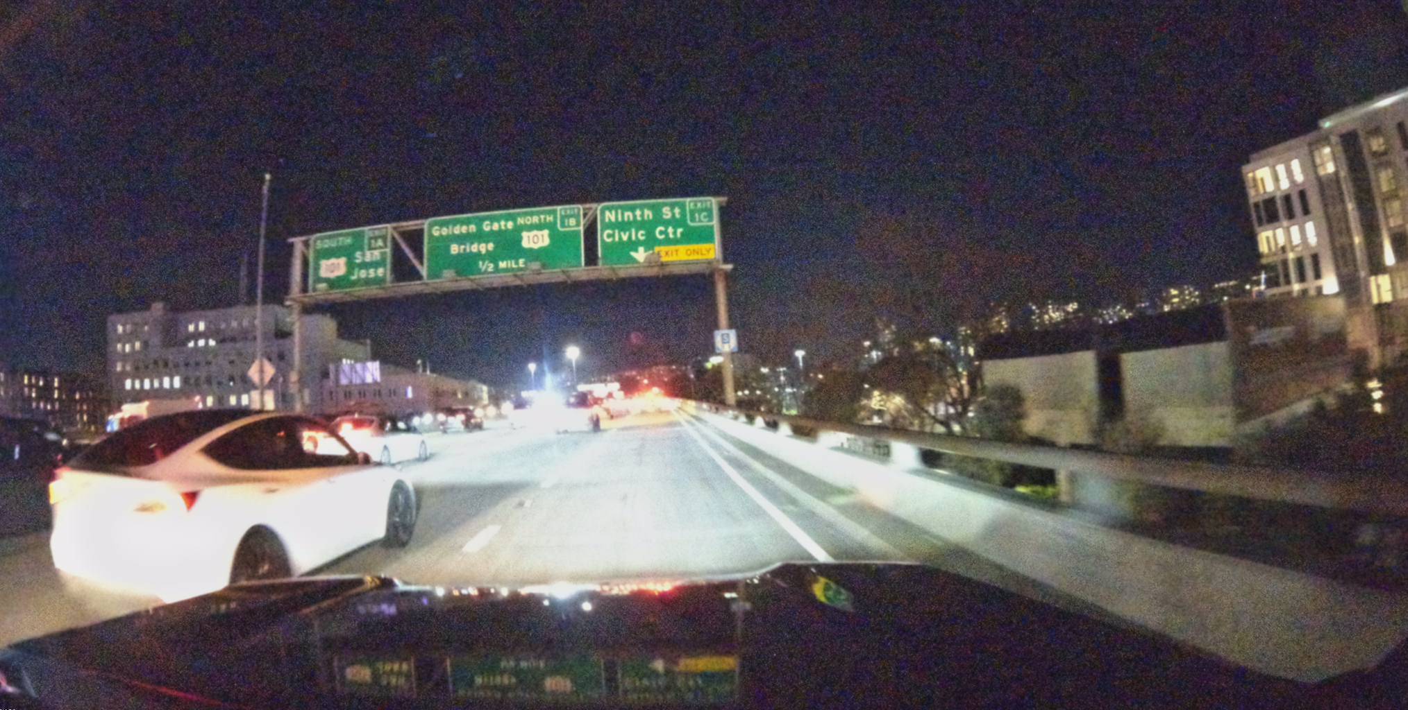
One feature stands out.
A highway sign near the SoMa on-ramp. Independently detected 154 times. The most-confirmed map feature in the entire dataset.
View metadata
Try this API query
curl -X POST "https://beemaps.com/api/developer/map-data?apiKey=<your-api-key>" \
  -H "Content-Type: application/json" \
  -d '{
    "type": ["mapFeatures"],
    "geometry": {
      "type": "Polygon",
      "coordinates": [[
        [-122.4045, 37.7761],
        [-122.4025, 37.7761],
        [-122.4025, 37.7781],
        [-122.4045, 37.7781],
        [-122.4045, 37.7761]
      ]]
    }
  }'
First detected: November 2023. Most recently confirmed: February 2025. Over that 15-month span, 154 different Bee devices passed this sign. Each one independently read it, recorded its position, refined the dataset's understanding of exactly where it is and what it says.
A nearby sign stores richer metadata. The Bee extracted the exit name ("Ninth St") and exit number ("1C") directly from the sign face. Not from a highway database. From the physical sign, read by a camera, 7 separate times.
View metadata
Try this API query
curl -X POST "https://beemaps.com/api/developer/map-data?apiKey=<your-api-key>" \
  -H "Content-Type: application/json" \
  -d '{
    "type": ["mapFeatures"],
    "geometry": {
      "type": "Polygon",
      "coordinates": [[
        [-122.4045, 37.7760],
        [-122.4025, 37.7760],
        [-122.4025, 37.7780],
        [-122.4045, 37.7780],
        [-122.4045, 37.7760]
      ]]
    }
  }'
11:25 AM
Four minutes in. A mile covered.
Metadata
Try this API query
curl -X POST https://beemaps.com/api/developer/imagery/latest/poly \
-H "Authorization: Basic <your-api-key>" \
-H "Content-Type: application/json" \
-d '{
"polygon": [
[-122.4090, 37.7757],
[-122.4070, 37.7757],
[-122.4070, 37.7777],
[-122.4090, 37.7777],
[-122.4090, 37.7757]
]
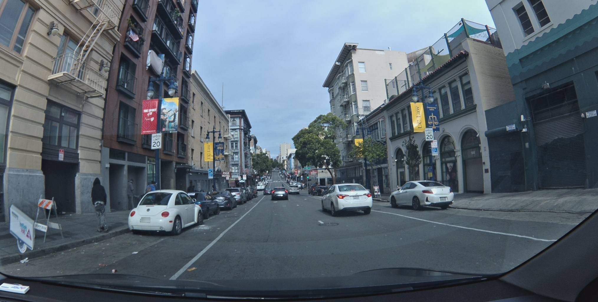
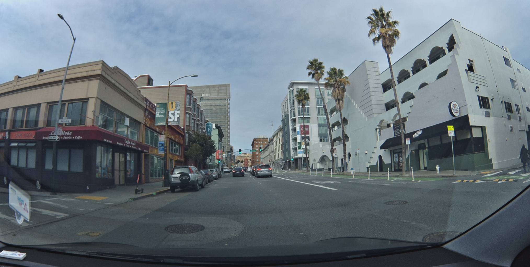
}'Count what's visible in a single frame:
- A "SPEED LIMIT 25" sign on the right
- A yellow "PEDESTRIAN CROSSING AHEAD" sign on the far left
- Orange construction barriers lining the left side
- Traffic cones marking a lane shift
- A "5th St" street sign
- Crosswalk markings at the intersection
- A "California" graffiti mural on the building to the right
You are watching the silver Toyota ahead of you. The Bee is watching everything else.
This is the asymmetry. Human attention is a spotlight — it illuminates one thing at a time. The car ahead. The light turning green. The pedestrian stepping off the curb. The Bee's attention is a floodlight. The entire 180-degree forward view. 2028 pixels wide. Every frame processed through computer vision models that identify, classify, and geolocate every object in the scene.
You see the road. The Bee sees the map.
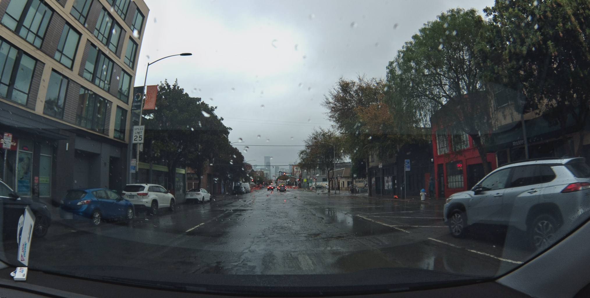
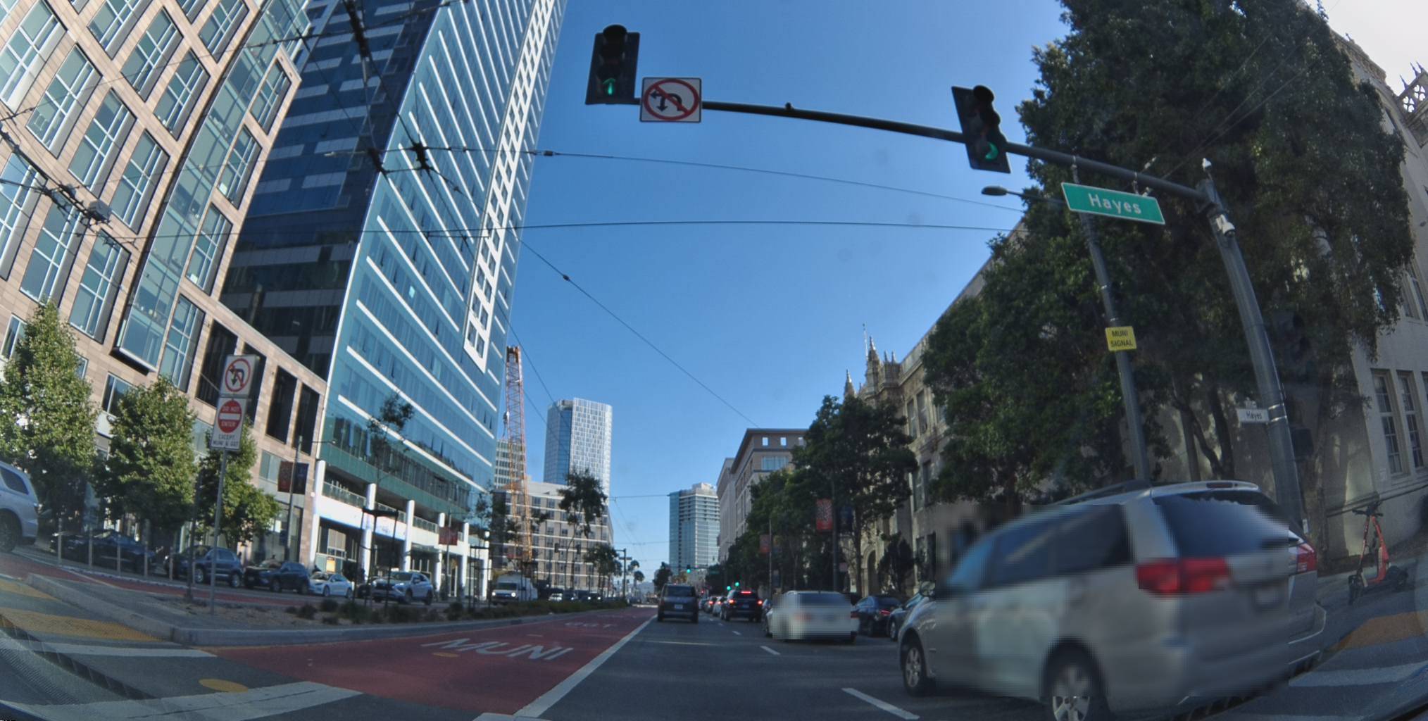
11:31 AM
A quieter stretch. Palm trees. Storefronts. Parked cars.
Metadata
Try this API query
curl -X POST https://beemaps.com/api/developer/imagery/latest/poly \
  -H "Authorization: Basic <your-api-key>" \
  -H "Content-Type: application/json" \
  -d '{
    "polygon": [
      [-122.4110, 37.7774],
      [-122.4090, 37.7774],
      [-122.4090, 37.7794],
      [-122.4110, 37.7794],
      [-122.4110, 37.7774]
    ]
  }'
The kind of block you forget the moment you drive past it. But the Bee is still working. Reading the street name sign ahead. Noting the lane markings. Logging the traffic signal state. This frame — one of 247 — will be processed for every road feature visible in the field of view.
The Bee doesn't distinguish between interesting and uninteresting. It doesn't get bored. It doesn't look away.
The Receipt
One drive. Ten minutes. Here is what it produced:
| Data Type | Count |
|---|---|
| Dashcam frames linked to map features | 247 |
| Speed signs in the corridor | 18 |
| Turn restriction signs | 36 |
| Parking restriction signs | 17 |
| Highway signs | 15 |
| Fire hydrants | 11 |
| Stop signs | 3 |
| Total map features in corridor | 100 |
Each frame: 2028x1024 pixels. GPS coordinates accurate to sub-meter precision. Full IMU telemetry. Camera orientation. Millisecond timestamp.
Each map feature: classification, GPS position, compass heading, first detection date, most recent confirmation, total independent detections.
A human driver produces none of this.
Now Multiply
One drive. 100 features. 247 frames linked to those features alone.
A fleet of 50 vehicles. Ten drives a day. That's 500 drives. 50,000 features tracked. 123,500 frames captured. Every day.
Over a month, that fleet builds a living map of its operating territory. Every speed sign read. Every turn restriction catalogued. Every fire hydrant positioned. Every parking restriction classified. Not from a database compiled last quarter. From cameras that drove the route this morning.
Signs don't change often. But they change. A new construction zone. A speed limit drops for a school zone. A turn restriction added at a dangerous intersection. A fire hydrant relocated during utility work. Static maps catch up eventually.
The Bee catches it on the next pass.
The Bee Never Blinks
In 10 minutes of driving, you consciously noticed maybe five things. A construction zone. A couple of lights. The 20 mph signs near UC Law — those are hard to miss. The turn you were about to take.
The Bee noticed 100.
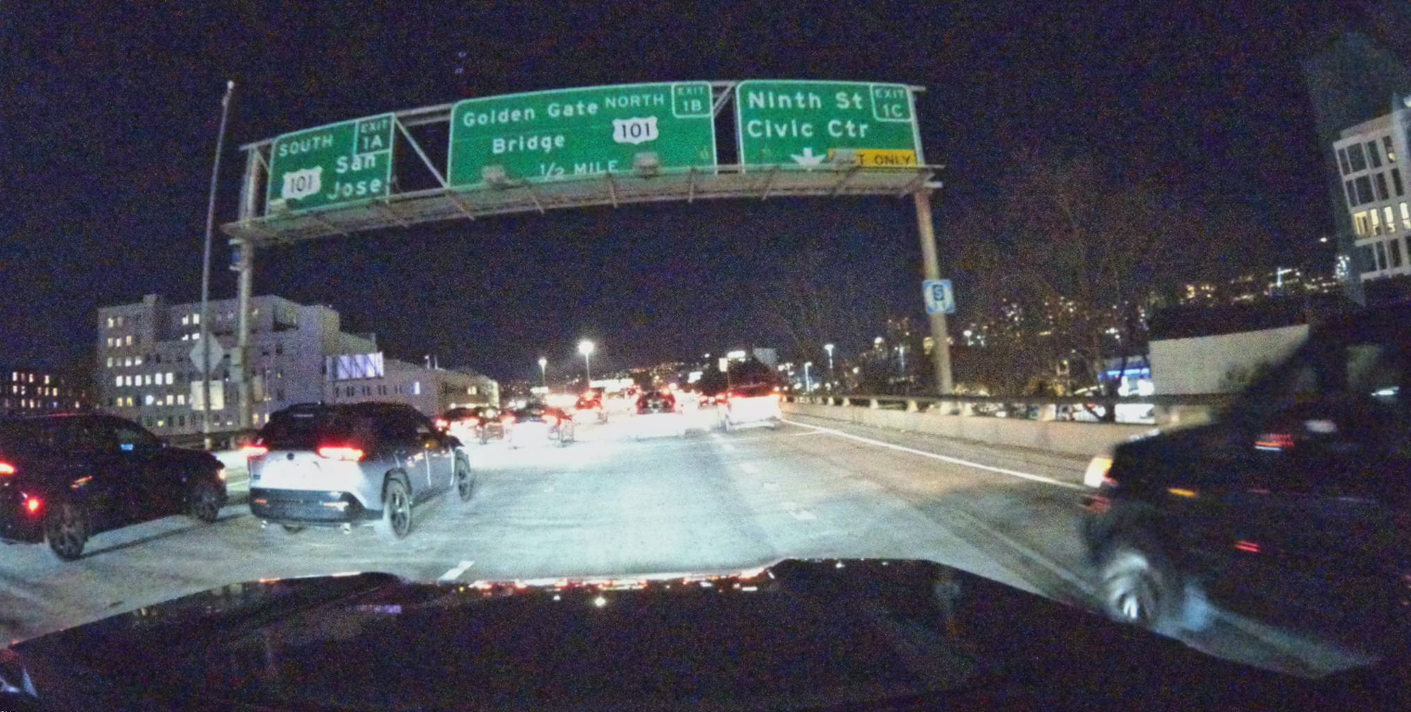
The fire hydrant at the corner you've driven past a hundred times and couldn't tell anyone is there. The parking restriction signs you've been ignoring for years. The compound "no U-turn, no left turn" sign you've only ever processed as "don't turn here." The highway sign that says "Ninth St, Exit 1C" — a sign you've passed 154 times without reading.
You are good enough to get from A to B.
The Bee is good enough to map the world along the way.
It never blinks.
Follow us on X or Try Bee Maps for Free.