
The Network is Buzzing
Places & Faces: Graylark

This is the second in a series that showcases the people who use data from Bee Maps, powered by Hivemapper, to solve real-world problems.
Dan Heinen knew he’d built something cool, but he never expected it to be a viral smash hit.
Heinen is the co-founder and CEO of Graylark Technologies, whose superpower is its ability to help law enforcement agencies investigate crimes using an AI technique called geolocalization that can pinpoint where in the world a photo was taken.
Two years ago, it was just a side project.
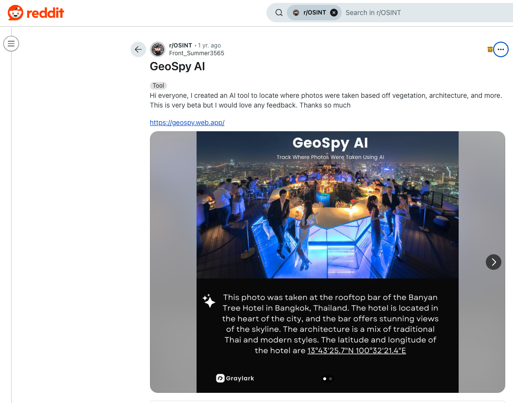
In 2023, Heinen was an AI research engineer at a defense contractor outside Boston. He was mostly working with drones. When he learned about a cutting-edge geolocalization technique called PIGEON developed by researchers at Stanford University, Heinen was inspired to build an app as a side project. He called it Geospy.
Heinen shared the tool on Reddit, allowing anyone to import a photo and predict the location of the photo by comparing it against other publicly available imagery.
It spread like wildfire.
Within months, the tool had grown to more than half a million monthly active users. Some users slyly used it to help them win at Geoguessr, the popular web-based game where people look at street-level imagery and guess where in the world it came from.
That was a trivial use case, but the power became clear to Heinen almost immediately. Every day, Heinen would learn about another way people were using his tool for good.
One striking example: A law enforcement agency successfully rescued a human trafficking victim by using Geospy to get an approximate location from a photograph, then working with local authorities in that area to search for a vehicle using license plate readers.
“I know we’re helping people and saving lives,” Heinen says. “We’re investing in making this technology better, more accurate, so we can help the people who need it the most – drug trafficking, human trafficking, those types of situations.”
The early version of the tool could give a rough estimation of the location of images. With a smattering of imagery from all around the world, the AI could learn to identify elements of the photo – like specific types of trees, cars or street signs – and use those to inform its guess.
Finding the right data source was a challenge. Some sources of imagery were too outdated to be particularly reliable, and others were prohibitively expensive or came with license requirements that made them impractical to use for training AI.
Ultimately, Graylark found several open datasets of geotagged imagery that would serve his needs, including Bee Maps, powered by Hivemapper, as well as Flickr and Mapillary.
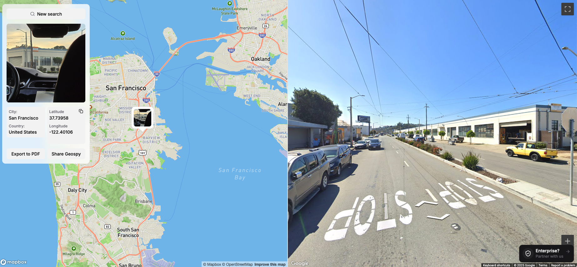
But the team had bigger ambitions. They didn’t just want to guess the country or city where a photo was taken. They wanted to be able to pinpoint the location within meters.
Graylark’s most advanced tool, Superbolt, can scan millions of street-level images to allow users like law enforcement, government agencies and journalists to identify the location of an image based on small visual details like the shapes of windows.
With a huge trove of recent street-level imagery, and the ability to quickly add imagery in areas of interest, the Hivemapper Network is a foundational data source that will allow Graylark’s technology to live up to its potential, Heinen says.
Besides just consuming Hivemapper data, Graylark is also helping to grow the network by ordering the Bee, the next-generation mapping machine from Bee Maps. If a customer such as a law enforcement agency wants fresher data in its area, it can simply deploy cameras. And as the coverage of the Hivemapper Network grows, so will the precision of its matches.
"Hivemapper is a great example of an open, community-led project where you can actually build AI without having to worry about all of the data restrictions,” Heinen says. “It’s crowdsourced, so there’s a ton of data, and you can train on it. I think that’s really important for the future of AI – it democratizes the technology.”
You can view the full video interview here.
–
Our mission at Bee Maps, powered by Hivemapper, is to improve people’s lives through fresher, more accurate map data. Whether you’re in the public sector or the private sector, whether you’re refreshing an app or refreshing an intersection, we’re here to help. Contact us today!


