
Fleet managers know the drill. You need dashcams, GPS tracking, and driver safety monitoring. You call the big fleet telematics vendors. They quote you $30-40 per vehicle per month, lock you into a multi-year contract, and send a team to do a weeks-long "onboarding." Half the features you're paying for — ELD compliance modules, fuel card integrations, maintenance schedulers — you'll never touch.
There's a better way. Bee Maps gives you the fleet management capabilities that actually matter — live tracking, AI-powered safety events, remote video, trip history, driver management — at $19/month per vehicle. No contracts. No onboarding team. Mount the dashcam, connect it, and you're live.
And here's what legacy platforms can't offer: every mile your fleet drives also builds fresh map data and road intelligence for physical AI. Your vehicles do two jobs at once.
AI That Runs on the Camera, Not in a Sales Deck
Most legacy fleet platforms bolt "AI" onto decade-old architectures. They upload raw video to the cloud, process it on remote servers, and charge you for the compute. The result is slow, expensive, and dependent on connectivity.
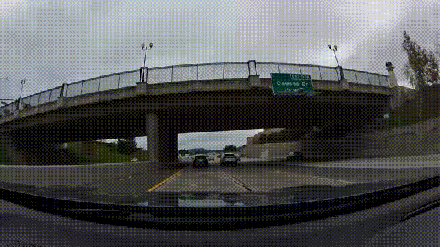
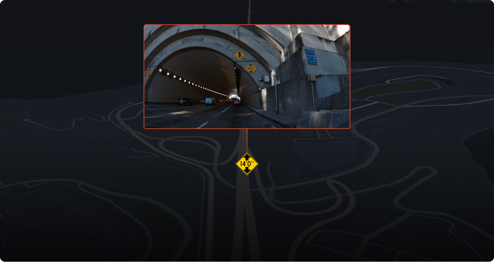
Bee Maps is AI-native. Computer vision models run directly on the dashcam hardware. The device itself detects safety events in real time — harsh braking, aggressive acceleration, swerving, high-speed driving, tailgating, stop sign violations, and traffic light violations. Each event comes with a video clip, GPS coordinates, speed data, and a timestamp. No cloud processing delay. No bandwidth bill for uploading hours of raw footage.
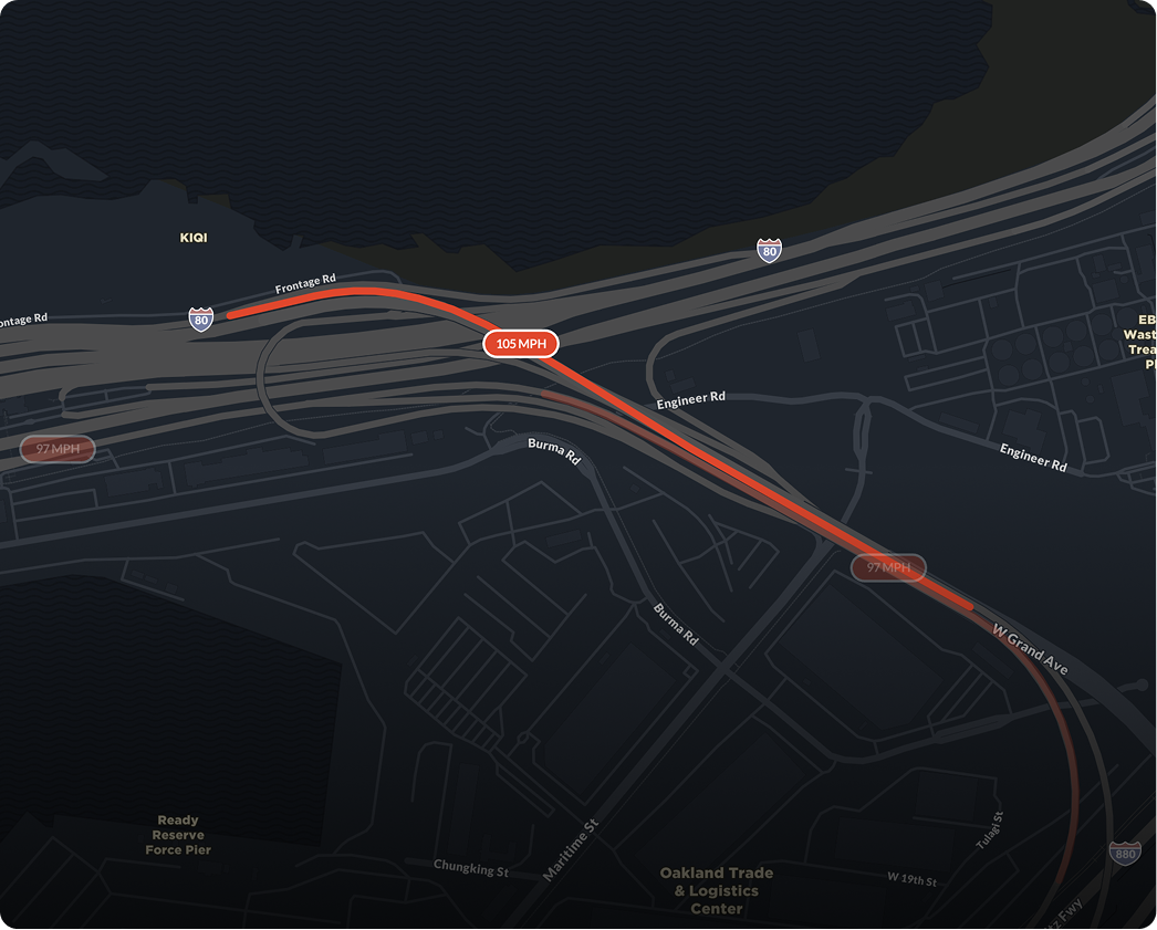
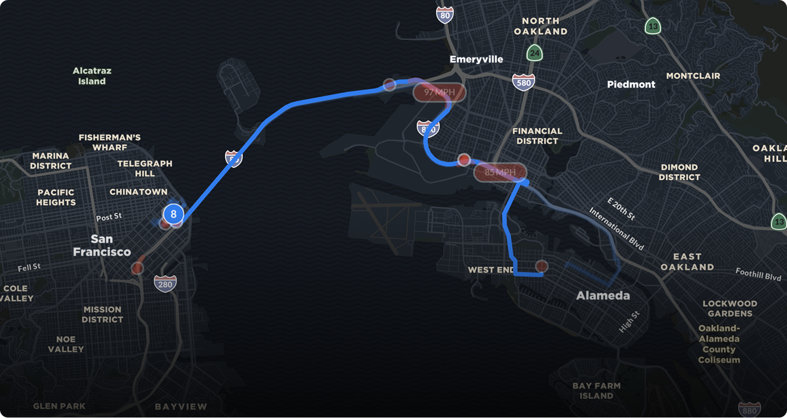
Here's what one of these events actually looks like — a near-collision on Highway 101 near Camarillo, California. The driver went from 70.7 mph to a near-stop in 28 seconds:
Metadata
Try this API query
curl https://beemaps.com/api/developer/aievents/69581dad62cb7e369e720878\
?includeGnssData=true\&includeImuData=true \
  -H "Authorization: Basic <your-api-key>"
Filter by driver, event type, or date range to spot patterns. Maybe one driver has a harsh braking problem on a specific route, or a particular intersection generates swerving events across multiple drivers. The data surfaces coaching opportunities — not as surveillance, but as evidence.
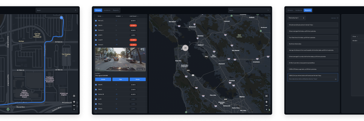
Live GPS Tracking
Bee Maps shows every vehicle on a live map with continuous location updates. Each device reports its status — moving, idle, connected, offline — so dispatchers can make decisions instantly.
Need to find the closest driver to a job? Proximity search does that in seconds. Want to know if a vehicle has been sitting idle too long? Status indicators surface that without anyone asking.
No per-seat charges for dispatchers. No tiered pricing to unlock the map view. The whole team sees the whole fleet.
Remote Video Retrieval
Customer complaint? Insurance claim? Driver dispute? Pull video from any connected dashcam remotely. Select a time window, the device receives the instruction, and the footage uploads.
No SD cards. No waiting for the vehicle to return to the yard. The system tracks request status — pending, received, acknowledged, completed — so you always know where your footage stands.
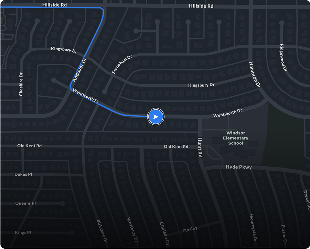
Trip History and Distance Tracking
Every trip is logged with full route polylines, start and end locations, timestamps, and distance calculations. Review trips across any time window — today, last 7 days, last 30 days, or all time.
Mileage reporting, route optimization, proof of service, compliance documentation — all built in. No add-on module. No upgrade tier.
Deploy in Minutes, Not Months
Legacy fleet platforms treat deployment like an enterprise software rollout. Site surveys, professional installation, IT integration projects, training sessions. Weeks or months before you see value.
Bee Maps deployment looks like this: mount the dashcam on the windshield, plug it in, connect it to your account. That's it. The device handles the rest — GPS, cellular connectivity, AI processing, video storage. No wiring harnesses. No OBD-II ports. No fleet-wide downtime for installation.
Want to add 10 more vehicles next month? Order the dashcams, mount them, done. Want to move a camera from one vehicle to another? Unplug it and replug it. The simplicity isn't a compromise — it's a design choice. The hardware does the hard work so the setup doesn't have to.
Driver Management Without the Overhead
Each vehicle can be assigned to a driver with customizable profiles. Track performance through AI event history and identify coaching opportunities. Vehicle records include license plates, vehicle type, descriptions, and custom fields your team defines.
The approach is practical, not punitive. When drivers know that harsh braking and swerving get flagged automatically, behavior changes. The data proves it.
What Legacy Platforms Can't Do: Build the Map
Here's where Bee Maps is fundamentally different from every other fleet platform on the market.
Every commercial vehicle running a Bee Maps dashcam is doing two jobs at once. The first job is whatever that vehicle was dispatched to do — deliver a package, service an HVAC unit, haul freight. The second job is observing the world through a calibrated camera and uploading what it sees.
That data becomes:
- Fresh street-level imagery — not stale, years-old photos from legacy map platforms, but imagery from today, from the roads your vehicles actually travel
- Detected road features — speed limit signs, stop signs, turn restrictions, traffic lights, lane markings — a structured, machine-readable map layer for autonomous vehicles and ADAS systems
- Real-world driving behavior — where drivers brake hard, slow down unexpectedly, or swerve, encoding the unwritten rules of the road that no surveyor captures
- Continuous network coverage — a fleet of 50 vehicles generates orders of magnitude more coverage than a handful of dedicated mapping cars, and does it every day
Legacy fleet platforms treat dashcam footage as a liability to store and delete. Bee Maps treats it as an asset — not just for your fleet, but for the entire ecosystem of physical AI systems being built today. Autonomous vehicles, delivery robots, insurance underwriting, city planning, real estate analysis — all of them need what your fleet naturally produces: a continuous, up-to-date view of the physical world.
The Bottom Line
You get the fleet management capabilities your team needs every day. Your vehicles get a second job — building the freshest map on the planet. And you pay a fraction of what the legacy vendors charge to make it all happen.
Follow us on X or Try Bee Maps for Free.