The Latest Buzz
What are the Different Types of Traffic Signs in Germany?

Germany is a nation where they take driving seriously. Despite the perception of unaware foreigners of it being a country with no speed limits, all things traffic safety from driving laws to traffic signs to standards for road maintenance are all extremely well designed and established in Deutschland. Germany goes the extra mile (no pun intended) to maintain safe roads they even have a sign to alert drivers of an uncontrolled intersection.
This article focuses on the main types of traffic signs in Germany, while also highlighting their relevance to urban planners and developers of autonomous vehicles.
Regulatory Signs: Rules and Restrictions
Regulatory signs play a vital role in communicating rules that drivers must follow. These signs are often circular and can be either red or blue, each serving different functions.
- Prohibitory Signs: Signs with a red border generally indicate prohibitions. These include "No Entry," "No Overtaking," and speed limits, ensuring drivers adhere to traffic rules. Restrictions for specific vehicle types, such as those based on weight or height, are also common. For example, signs like "No Vehicles Over 3.5 Tons" help manage heavy traffic flow, a crucial consideration in urban areas.
- Mandatory Signs: Blue circular signs indicate mandatory actions like "Turn Right" or "Minimum Speed." They are essential for directing traffic through complex intersections and ensuring that vehicles, including autonomous ones, navigate safely.
Understanding these signs is critical for developers working on autonomous vehicle systems, as these rules dictate how vehicles should behave in different environments, helping to ensure compliance with local traffic regulations.
Warning Signs: Preparing for Hazards
Germany’s warning signs are typically triangular with a red border, alerting drivers to potential hazards. Their standardized design helps drivers and autonomous systems alike recognize and respond to potential dangers.
- Common Warning Signs: These signs include warnings for sharp bends, steep hills, and pedestrian crossings. For instance, a triangular sign with a symbol of children indicates proximity to a school zone, where drivers should reduce speed.
- Weather-Related Warnings: Germany’s road network includes warnings for environmental conditions like "Slippery Roads" or "Risk of Snow or Ice." These are particularly useful in regions with unpredictable weather, allowing vehicles to adjust their speed and driving behavior accordingly.
In autonomous vehicle training, understanding how "warning signs" function can improve navigation accuracy and safety. The more precise or up-to-date the map data, the better autonomous systems can be trained to detect and interpret these signs in real-world conditions.
Information Signs: Guiding Drivers and Enhancing Navigation
Information signs in Germany are rectangular and provide vital details about directions, facilities, and road conditions. They use various colors to distinguish between different road types, making navigation more intuitive.
- Direction Signs: Green signs guide drivers on the Autobahn (motorway), while yellow signs are used for regional roads, and white signs for local routes. These signs include distance markers and directions to nearby towns or services, crucial for mapping and navigation.
- Facility Signs: Information about nearby facilities such as hospitals, service areas, or fuel stations is displayed on these signs. For autonomous vehicle developers, this information is key to enhancing map data, ensuring vehicles can navigate to and from these essential locations accurately.
- Urban Navigation: Signs indicating low-emission zones, parking zones, and pedestrian areas are particularly relevant for urban planning and autonomous vehicles operating in city environments. These zones help manage traffic flow and reduce environmental impact, making them essential for sustainable urban design.
Temporary Signs: Managing Dynamic Road Conditions
Temporary road signs are used for construction zones, road work, and temporary traffic management. These signs provide crucial information about changes in the road layout, such as lane closures or temporary speed limits.
- Road Work Signs: Temporary signs like "Road Works Ahead" or lane closure indicators are used to redirect traffic during maintenance. They are especially relevant for mapping systems, as temporary changes can significantly impact traffic patterns.
- Manual Control Signs: In certain situations, such as construction sites, traffic control personnel may use manual signs like "Stop" or "Go." Autonomous vehicle developers must ensure that their systems can recognize and adapt to these manually controlled scenarios.
For city planners, integrating data about temporary signs into their systems can provide a real-time view of road condition projects and signage inventory, making planning easier and more efficient.
Special Signs: Catering to Specific Needs
Germany also uses special signs for unique situations, such as roads with restricted access, environmental zones, and signs specific to certain regions. For example, special traffic restriction zones are implemented to reduce air pollution in urban areas.
- Environmental Zones: These zones restrict access to vehicles based on their emission levels, indicated by signs at the zone's entry and exit. They play a significant role in Germany’s efforts to reduce urban pollution and traffic congestion.
- Bilingual and Regional Variations: Some regions in Germany, particularly those close to international borders, use bilingual signs to assist cross-border traffic. This is crucial for international logistics and autonomous systems that need to operate across different regions.
Enhancing Navigation with German Road Signs
Germany’s traffic sign system is designed to be comprehensive, ensuring that road users, including autonomous vehicles, can navigate safely and efficiently. By understanding the nuances of regulatory, warning, information, and temporary signs, urban planners and developers can optimize their strategies for managing traffic flow and enhancing road safety.
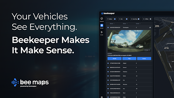
For urban planners, autonomous vehicle developers, and companies needing accurate map data, Bee Map's real-time street-level map imagery and map features api can equate to having a better performing and safer product in production. With precise data on road signs and conditions, you can create safer, more efficient transportation solutions.
Share Post


