There are billions of road signs on the planet. Speed limits, stop signs, turn restrictions, lane markings — and they're constantly changing. A city repaves a road and moves a sign ten feet. A new school zone drops the limit to 20 mph. A construction project adds a temporary no-left-turn that stays up for six months. No survey team can keep up with that. By the time a traditional mapping company catalogs a corridor, something has already changed.
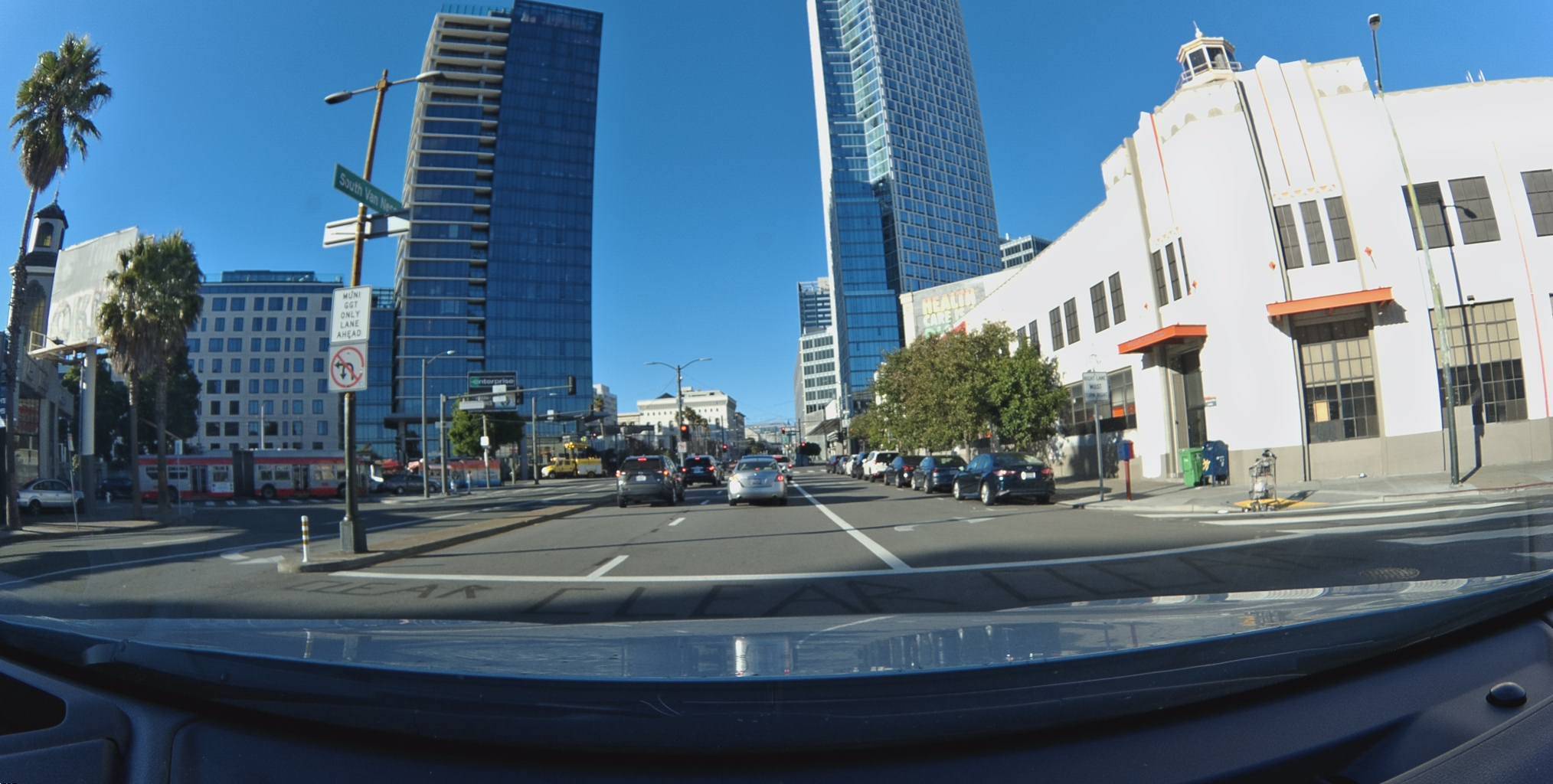
The Bee changes that — passively. Mount it on your windshield and drive. That's it. Every time the Bee passes a road feature, our Map AI detects it, classifies it, and — critically — positions it in 3D space. Not just "somewhere on Hollywood Boulevard," but at 34.1012°N, 118.3297°W, facing north at azimuth 5.8°.
No manual surveying. No special routes. No interaction required. The driver just drives, and the Bee quietly builds a precise, positioned inventory of every sign, signal, and road object it encounters.
Why This Data Matters
Before we dive into examples, here's why precise sign positioning is valuable:
- ADAS and autonomous vehicles need to know which direction a sign faces to determine if it applies to their lane of travel. A sign's azimuth — the compass direction it faces — gives them that. A 30 mph sign facing north applies to northbound traffic, not southbound.
- Speed limit compliance for EU regulations (ISA) requires knowing exactly where speed changes occur — not just that they exist somewhere on a road segment.
- City planners can audit sign placement, identify missing or redundant signs, and track sign conditions over time with firstSeen/lastSeen data.
- Insurance and fleet managers can verify whether a speeding event occurred in a 25 mph or 45 mph zone based on precise sign positions.
Every feature in this post comes with latitude, longitude, and azimuth — the compass direction the sign faces, measured in degrees from north (0° = north, 90° = east, 180° = south, 270° = west). That single number tells a routing engine or ADAS system exactly which direction of traffic a sign applies to.
Let's walk through real examples from three major US cities.
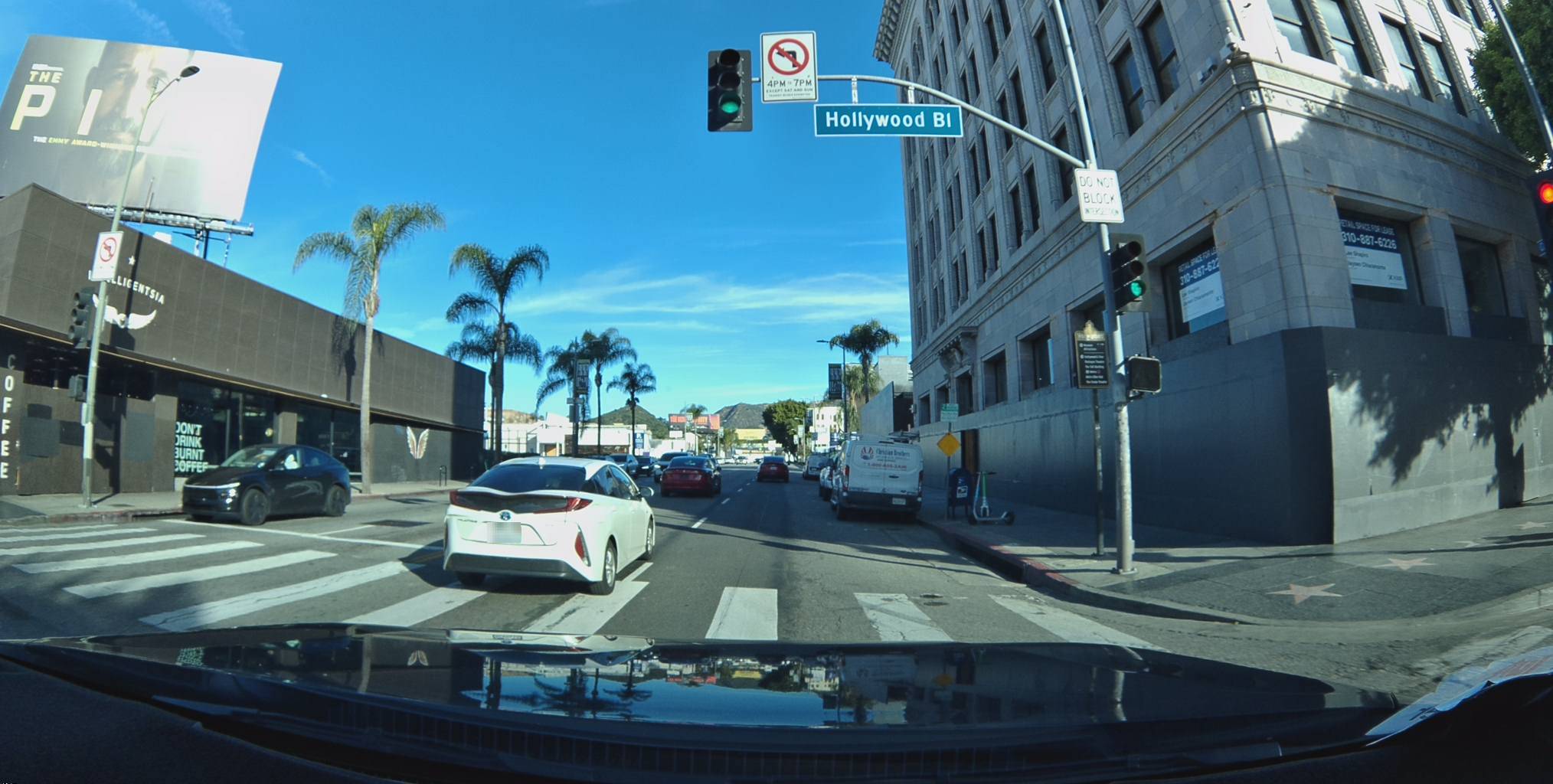
Los Angeles: Hollywood to Koreatown
LA is dense with road signage — turn restrictions on every boulevard, speed limits that change block by block. In just two small areas around Hollywood and Koreatown, the Bee has already mapped 80 road features — speed signs, turn restrictions, parking restrictions — and the count grows with every drive. Each time the Bee passes through, it either confirms what's already there or picks up something new.
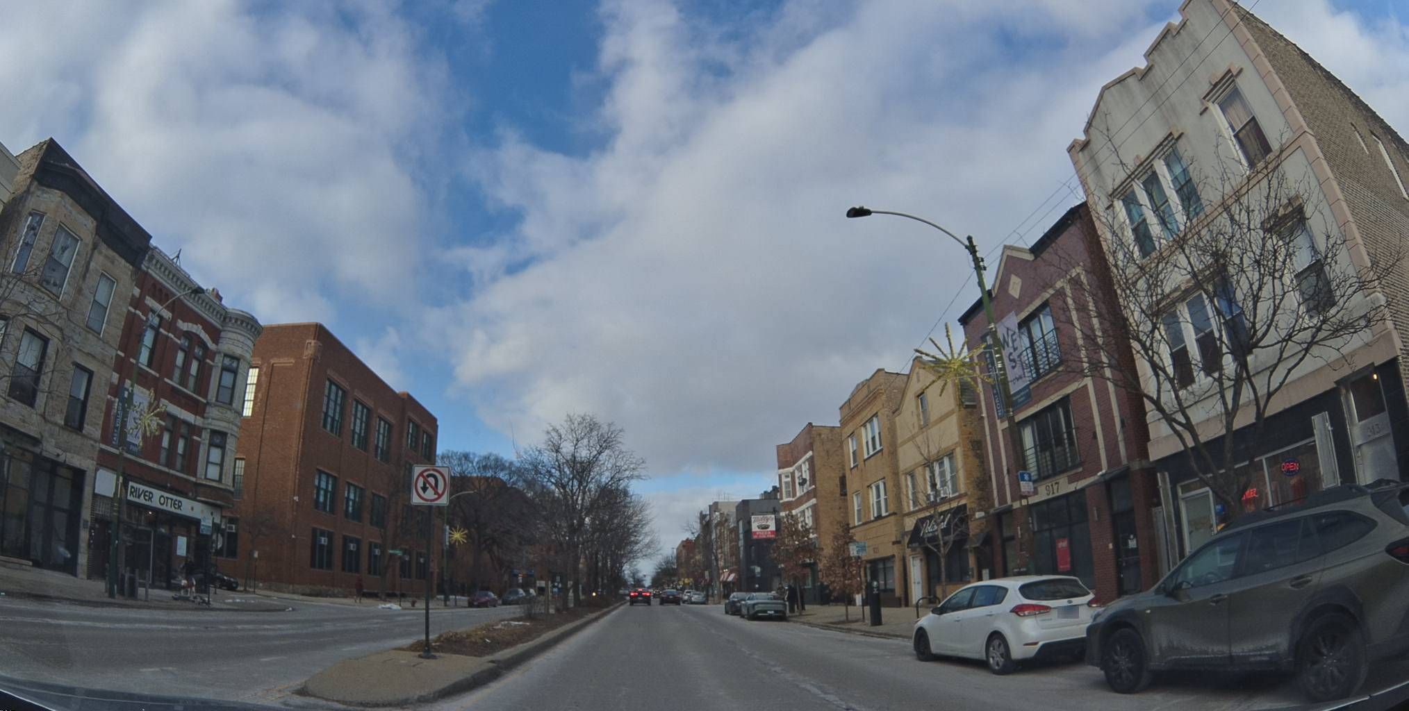
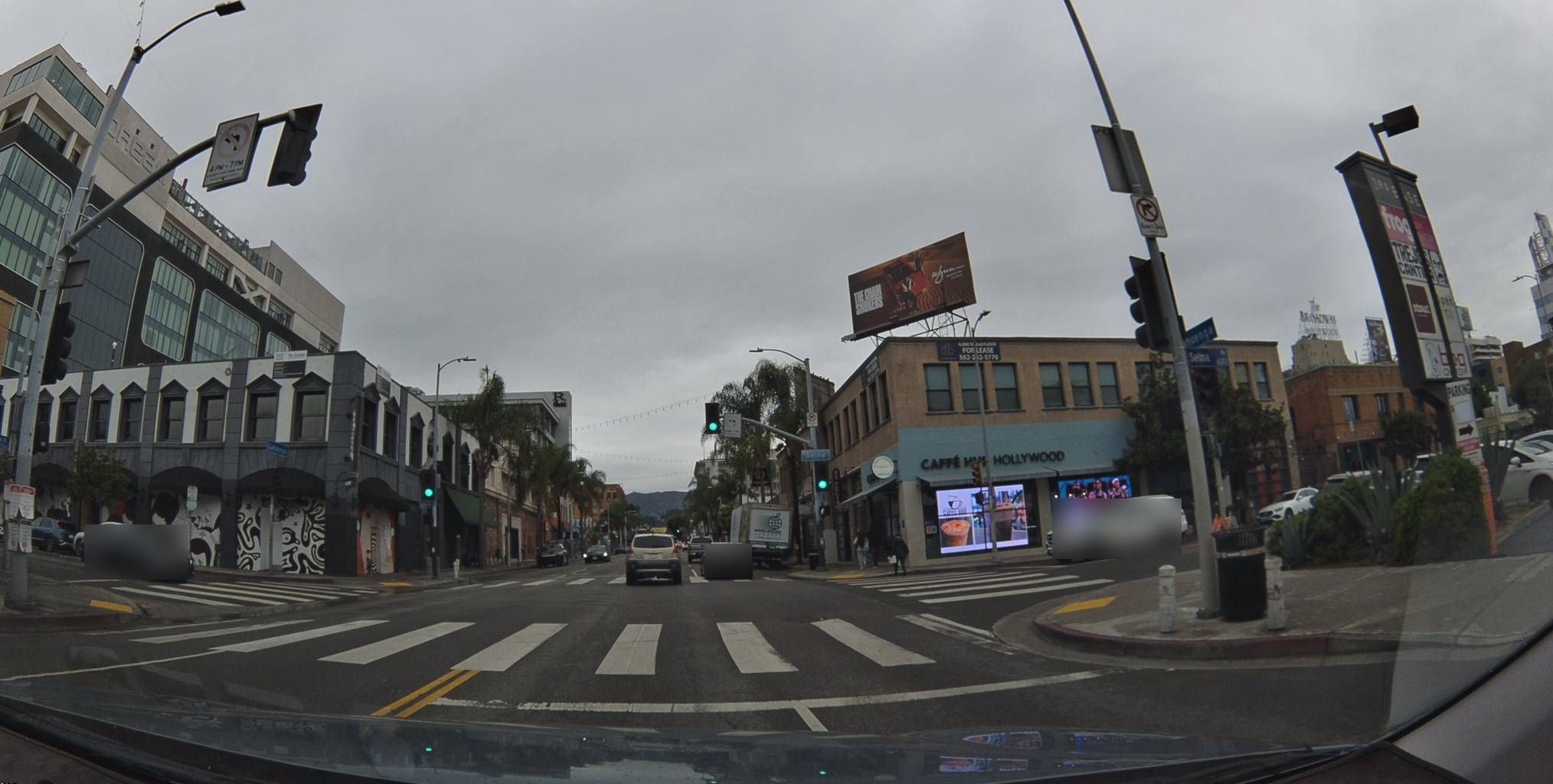
Speed Signs on Hollywood Boulevard
Here's a 25 mph speed sign detected near Hollywood and Vine. The Bee captured its exact position: 34.1015°N, 118.3291°W. The sign faces west (azimuth 263°). The driver who captured this was just going about their day — the Bee handled the rest.
View metadata
Try this API query
curl -X POST "https://beemaps.com/api/developer/map-data?apiKey=<your-api-key>" \
  -H "Content-Type: application/json" \
  -d '{
    "type": ["mapFeatures"],
    "geometry": {
      "type": "Polygon",
      "coordinates": [[
        [-118.3301, 34.1005],
        [-118.3281, 34.1005],
        [-118.3281, 34.1025],
        [-118.3301, 34.1025],
        [-118.3301, 34.1005]
      ]]
    }
  }'
Just a block away, a 30 mph sign faces north. This one has been observed multiple times between December 2023 and April 2025 — repeated observations from different drivers let us confirm the sign is still active and refine its position over time.
View metadata
Try this API query
curl -X POST "https://beemaps.com/api/developer/map-data?apiKey=<your-api-key>" \
  -H "Content-Type: application/json" \
  -d '{
    "type": ["mapFeatures"],
    "geometry": {
      "type": "Polygon",
      "coordinates": [[
        [-118.3307, 34.1002],
        [-118.3287, 34.1002],
        [-118.3287, 34.1022],
        [-118.3307, 34.1022],
        [-118.3307, 34.1002]
      ]]
    }
  }'
Turn Restrictions at Hollywood Intersections
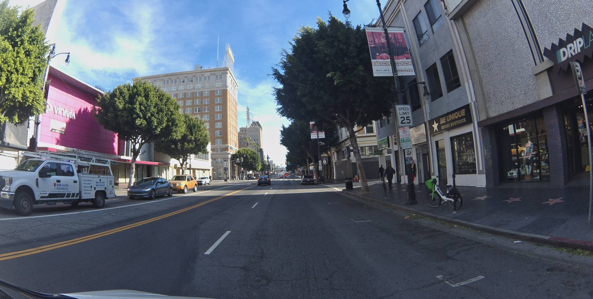
LA's grid has complex turn restrictions, especially along major corridors. Here's a no-left-turn sign at Hollywood and Highland, detected with 88.7% confidence. It's been confirmed across 19 months of observations — every Bee that drove past this intersection added another data point, all without the driver doing anything.
View metadata
Try this API query
curl -X POST "https://beemaps.com/api/developer/map-data?apiKey=<your-api-key>" \
  -H "Content-Type: application/json" \
  -d '{
    "type": ["mapFeatures"],
    "geometry": {
      "type": "Polygon",
      "coordinates": [[
        [-118.3305, 34.1007],
        [-118.3285, 34.1007],
        [-118.3285, 34.1027],
        [-118.3305, 34.1027],
        [-118.3305, 34.1007]
      ]]
    }
  }'
And a no-right-turn sign two blocks south, facing northwest at azimuth 326°. Observed across multiple drives in spring 2025.
View metadata
Try this API query
curl -X POST "https://beemaps.com/api/developer/map-data?apiKey=<your-api-key>" \
  -H "Content-Type: application/json" \
  -d '{
    "type": ["mapFeatures"],
    "geometry": {
      "type": "Polygon",
      "coordinates": [[
        [-118.3304, 34.0987],
        [-118.3284, 34.0987],
        [-118.3284, 34.1007],
        [-118.3304, 34.1007],
        [-118.3304, 34.0987]
      ]]
    }
  }'
No U-Turn on Wilshire Boulevard
Head south to Koreatown and the Bee picks up a no-U-turn sign on Wilshire near Western, facing east at azimuth 93°.
View metadata
Try this API query
curl -X POST "https://beemaps.com/api/developer/map-data?apiKey=<your-api-key>" \
-H "Content-Type: application/json" \
-d '{
"type": ["mapFeatures"],
"geometry": {
"type": "Polygon",
"coordinates": [[
[-118.2996, 34.0609],
[-118.2976, 34.0609],
[-118.2976, 34.0629],
[-118.2996, 34.0629],
[-118.2996, 34.0609]
]]
}
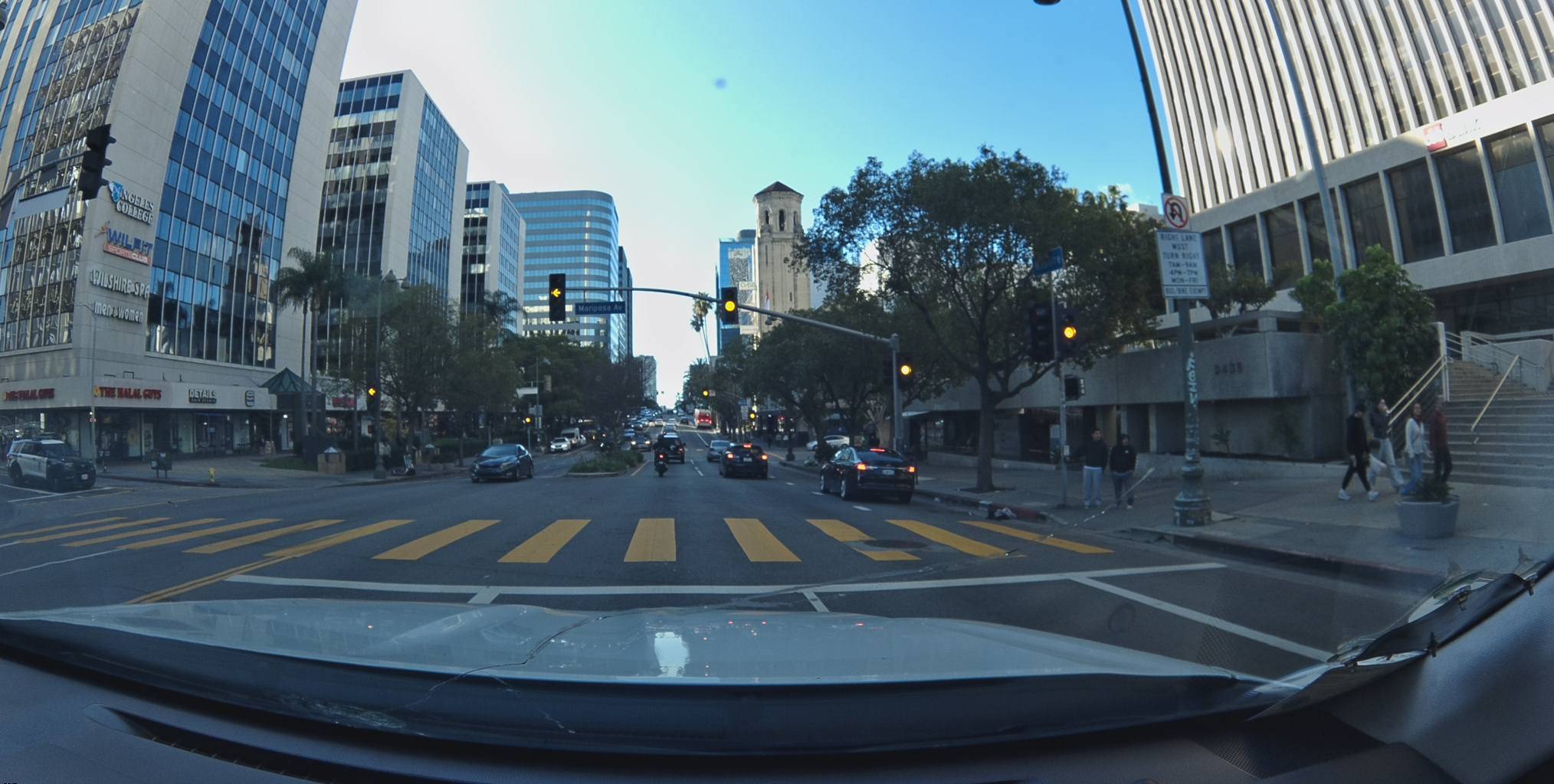
}'Chicago: The Loop to the Kennedy Expressway
Chicago's street grid is famously organized, but its speed limits vary significantly — from 30 mph downtown to 55 mph on the expressways. The Bee network captured 19 features across the Loop, Near North Side, and Wicker Park areas — all from drivers going about their normal commutes.
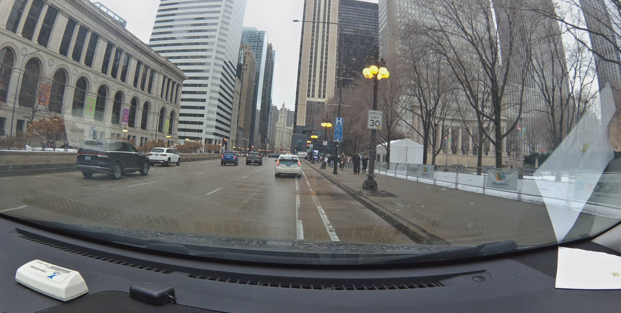
30 mph in The Loop
This speed sign sits right on Michigan Avenue in the Loop. It faces south at azimuth 181°. Two observations between May and July 2025 confirmed its position.
View metadata
Try this API query
curl -X POST "https://beemaps.com/api/developer/map-data?apiKey=<your-api-key>" \
  -H "Content-Type: application/json" \
  -d '{
    "type": ["mapFeatures"],
    "geometry": {
      "type": "Polygon",
      "coordinates": [[
        [-87.6252, 41.8826],
        [-87.6232, 41.8826],
        [-87.6232, 41.8846],
        [-87.6252, 41.8846],
        [-87.6252, 41.8826]
      ]]
    }
  }'
45 mph Near North Side
A few blocks northwest, the speed limit jumps to 45 mph. This sign near the intersection of Halsted and Division faces northwest at azimuth 319°.
View metadata
Try this API query
curl -X POST "https://beemaps.com/api/developer/map-data?apiKey=<your-api-key>" \
-H "Content-Type: application/json" \
-d '{
"type": ["mapFeatures"],
"geometry": {
"type": "Polygon",
"coordinates": [[
[-87.6515, 41.8998],
[-87.6495, 41.8998],
[-87.6495, 41.9018],
[-87.6515, 41.9018],
[-87.6515, 41.8998]
]]
}
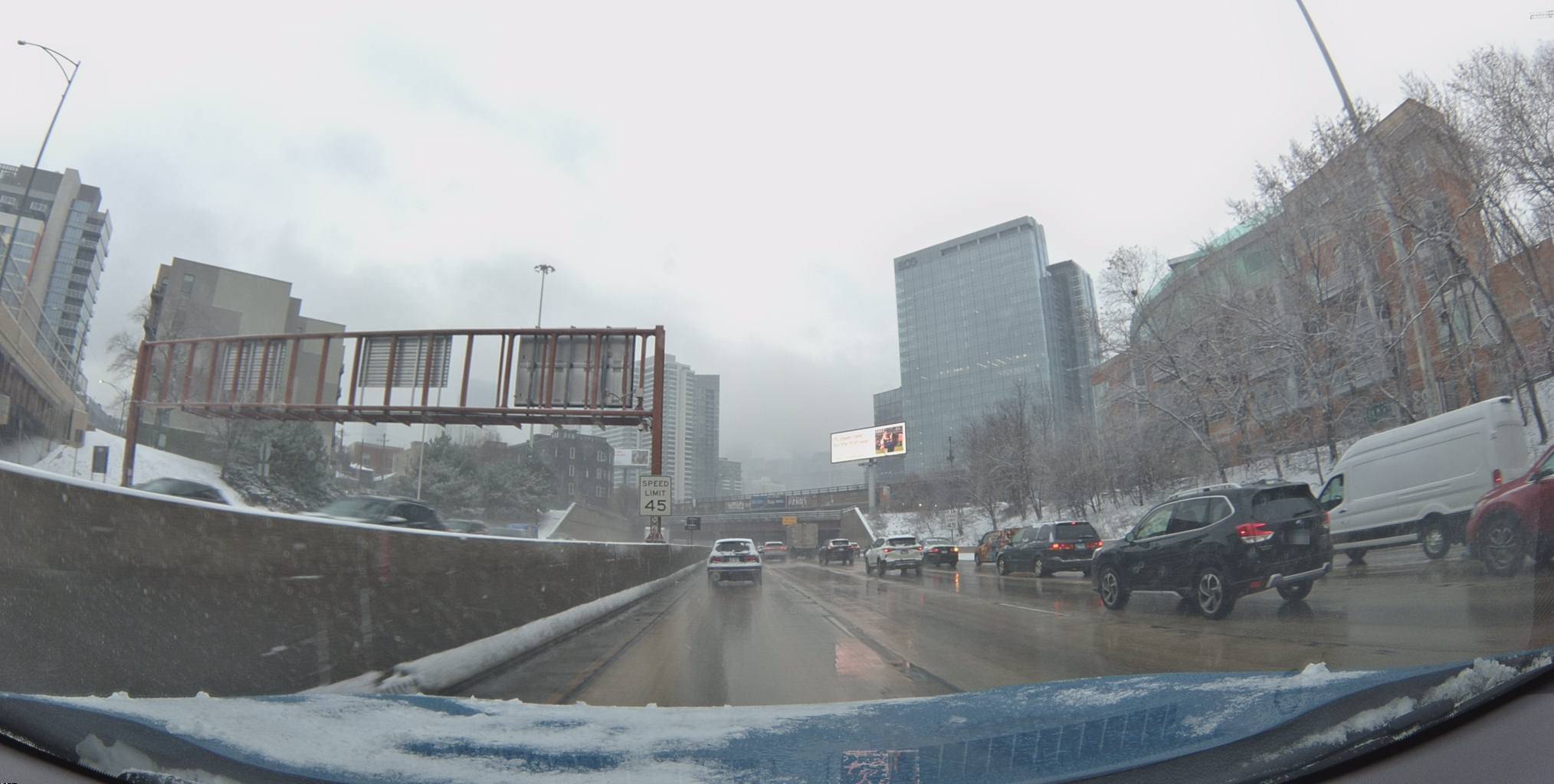
}'55 mph on the Kennedy Expressway
Head onto the Kennedy Expressway and the limit climbs to 55 mph. This sign was detected near the Wicker Park on-ramp, facing northwest. The azimuth of 339° tells you the exact direction the sign faces — useful for knowing which direction of traffic it applies to.
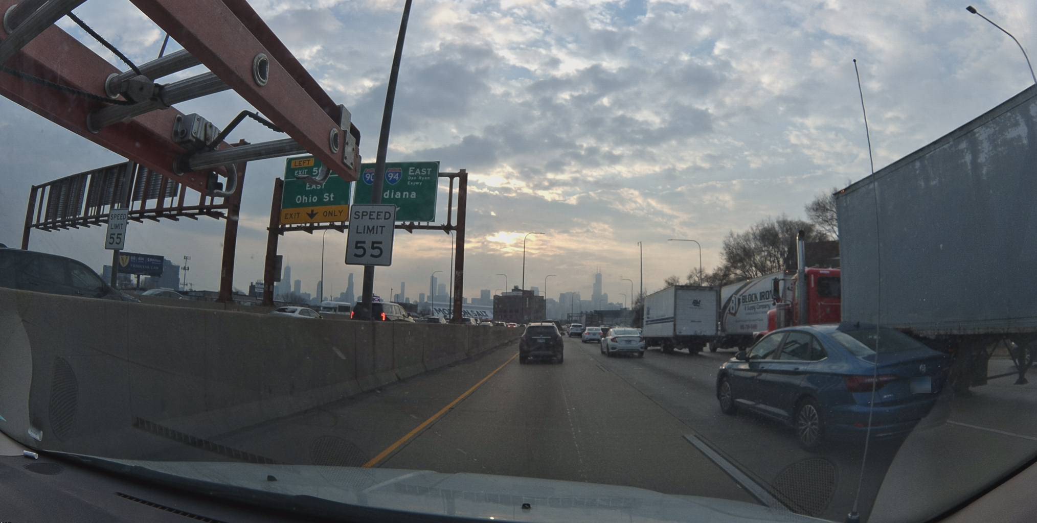
View metadata
Try this API query
curl -X POST "https://beemaps.com/api/developer/map-data?apiKey=<your-api-key>" \
  -H "Content-Type: application/json" \
  -d '{
    "type": ["mapFeatures"],
    "geometry": {
      "type": "Polygon",
      "coordinates": [[
        [-87.6639, 41.9073],
        [-87.6619, 41.9073],
        [-87.6619, 41.9093],
        [-87.6639, 41.9093],
        [-87.6639, 41.9073]
      ]]
    }
  }'
No U-Turn in Wicker Park
Wicker Park's angled intersections (where Milwaukee, North, and Damen collide) produce unusual turn restrictions. This no-U-turn sign faces south at azimuth 198°.

View metadata
Try this API query
curl -X POST "https://beemaps.com/api/developer/map-data?apiKey=<your-api-key>" \
  -H "Content-Type: application/json" \
  -d '{
    "type": ["mapFeatures"],
    "geometry": {
      "type": "Polygon",
      "coordinates": [[
        [-87.6683, 41.8974],
        [-87.6663, 41.8974],
        [-87.6663, 41.8994],
        [-87.6683, 41.8994],
        [-87.6683, 41.8974]
      ]]
    }
  }'
San Francisco: Speed Limit Changes in Real Time
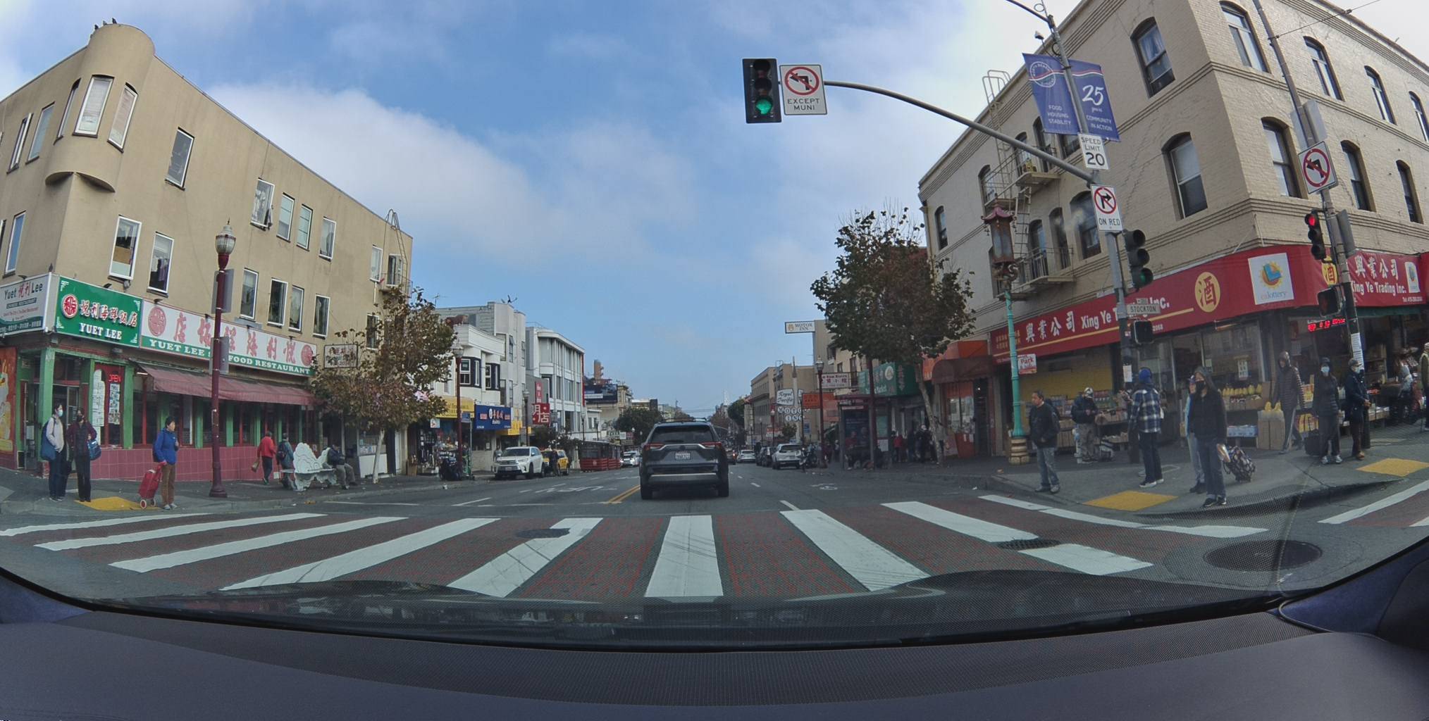
San Francisco's streets are in the middle of a major speed limit overhaul. Under California's AB 43, the city has been lowering limits from 25 mph to 20 mph across business districts and safety corridors — 79 corridors and 48.5 street miles as of September 2024. The Bee network is capturing this transition as it happens.
20 mph in North Beach
Near Columbus Avenue in North Beach, this 20 mph sign reflects one of the new reduced limits. San Francisco's slow-speed zones in pedestrian-heavy neighborhoods are critical data for routing engines and ADAS systems. The sign faces west at azimuth 256°.
View metadata
Try this API query
curl -X POST "https://beemaps.com/api/developer/map-data?apiKey=<your-api-key>" \
  -H "Content-Type: application/json" \
  -d '{
    "type": ["mapFeatures"],
    "geometry": {
      "type": "Polygon",
      "coordinates": [[
        [-122.4095, 37.7966],
        [-122.4075, 37.7966],
        [-122.4075, 37.7986],
        [-122.4095, 37.7986],
        [-122.4095, 37.7966]
      ]]
    }
  }'
25 mph in the Mission — Still the Old Limit
A few miles south in the Mission District, the standard 25 mph is still posted. This sign faces almost due north at azimuth 350°, and has been observed repeatedly over 16 months. When the city swaps this sign for a 20 mph, the Bee network will pick up the change on the next drive past — no manual survey needed.
View metadata
Try this API query
curl -X POST "https://beemaps.com/api/developer/map-data?apiKey=<your-api-key>" \
  -H "Content-Type: application/json" \
  -d '{
    "type": ["mapFeatures"],
    "geometry": {
      "type": "Polygon",
      "coordinates": [[
        [-122.4202, 37.7734],
        [-122.4182, 37.7734],
        [-122.4182, 37.7754],
        [-122.4202, 37.7754],
        [-122.4202, 37.7734]
      ]]
    }
  }'
This is the kind of real-world change that traditional map surveys miss. A city passes a law, crews swap signs over months, and the map needs to reflect what's actually on the ground — not what the ordinance says. The Bee captures what's physically there, as it changes.
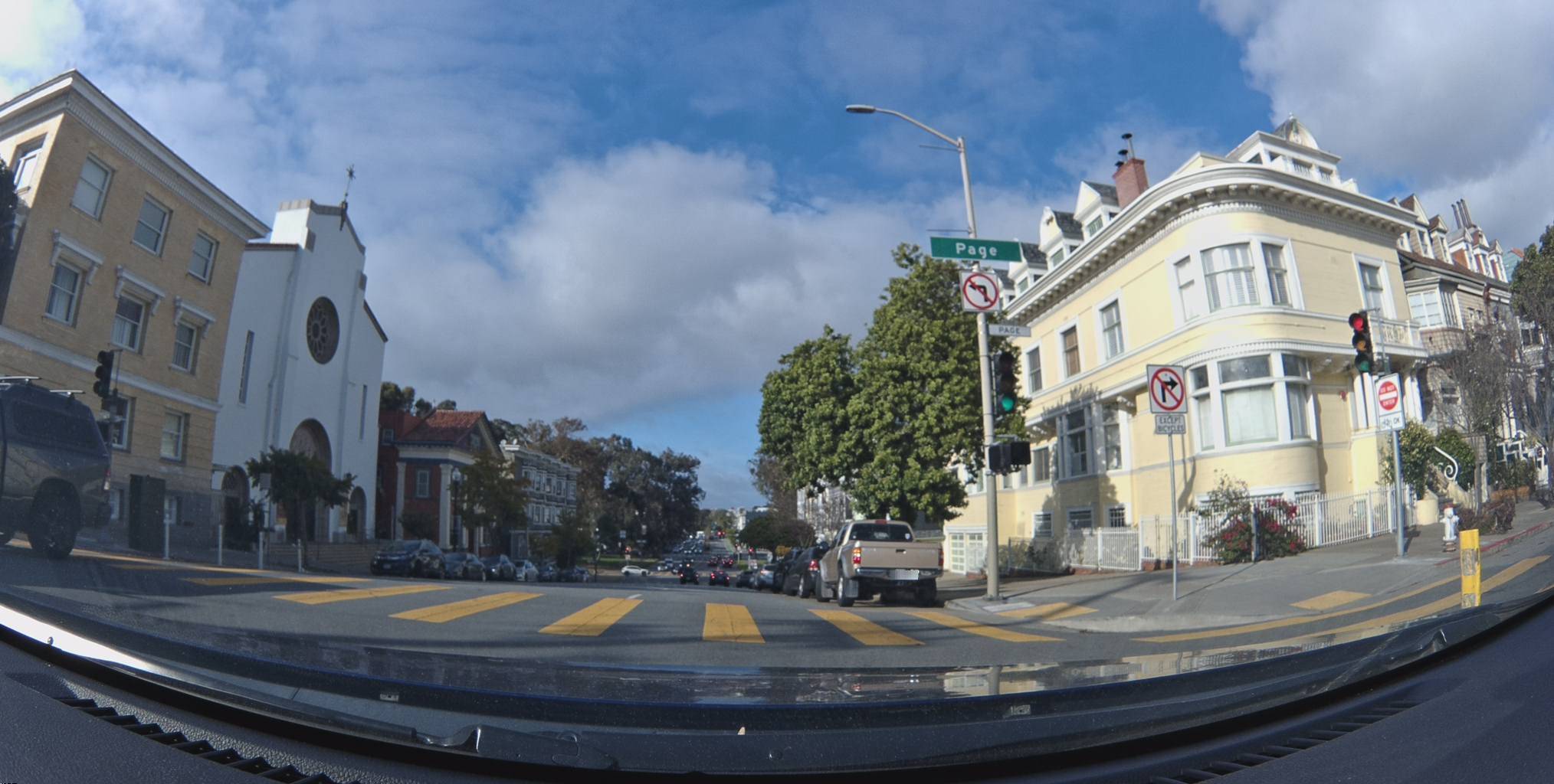
No Left Turn Near Haight-Ashbury
Where Haight Street meets the Panhandle, a no-left-turn sign faces almost due south (azimuth 177°). Detected with 97% confidence.
View metadata
Try this API query
curl -X POST "https://beemaps.com/api/developer/map-data?apiKey=<your-api-key>" \
  -H "Content-Type: application/json" \
  -d '{
    "type": ["mapFeatures"],
    "geometry": {
      "type": "Polygon",
      "coordinates": [[
        [-122.4465, 37.7703],
        [-122.4445, 37.7703],
        [-122.4445, 37.7723],
        [-122.4465, 37.7723],
        [-122.4465, 37.7703]
      ]]
    }
  }'
Combo Turn Restriction in the Castro
A no-U-turn / no-left-turn combination near Market and Castro. The sign faces south-southeast at azimuth 166°.
View metadata
Try this API query
curl -X POST "https://beemaps.com/api/developer/map-data?apiKey=<your-api-key>" \
  -H "Content-Type: application/json" \
  -d '{
    "type": ["mapFeatures"],
    "geometry": {
      "type": "Polygon",
      "coordinates": [[
        [-122.4194, 37.7713],
        [-122.4174, 37.7713],
        [-122.4174, 37.7733],
        [-122.4194, 37.7733],
        [-122.4194, 37.7713]
      ]]
    }
  }'
Speed Limits at a Glance
Here's a summary of the speed limits we found across all three cities:
| City | Speed | Location | Coordinates | Azimuth |
|---|---|---|---|---|
| LA | 25 mph | Hollywood & Vine | 34.1015, -118.3291 | 263° (W) |
| LA | 30 mph | Hollywood Blvd | 34.1012, -118.3297 | 6° (N) |
| Chicago | 30 mph | Michigan Ave | 41.8836, -87.6242 | 181° (S) |
| Chicago | 45 mph | Near North Side | 41.9008, -87.6505 | 319° (NW) |
| Chicago | 55 mph | Kennedy Expy | 41.9083, -87.6629 | 339° (NNW) |
| SF | 20 mph | North Beach | 37.7976, -122.4085 | 256° (W) |
| SF | 25 mph | Mission District | 37.7744, -122.4192 | 350° (N) |
The remarkable thing is that none of this required a dedicated survey team. Every feature in this post was captured by the Bee mounted on everyday vehicles — rideshare drivers, delivery vans, daily commuters. The device sits on the windshield, and the network does the rest.
Querying Map Features via the API
All of the features shown above are accessible through the Bee Maps Map Data API. Say you're an automaker building an ADAS system and you need every speed limit sign along a stretch of the Kennedy Expressway in Chicago. Here's how you'd query it:
curl -X POST "https://beemaps.com/api/developer/map-data?apiKey=YOUR_API_KEY" \
  -H "Content-Type: application/json" \
  -d '{
    "type": ["mapFeatures"],
    "geometry": {
      "type": "Polygon",
      "coordinates": [[
        [-87.665, 41.906],
        [-87.660, 41.906],
        [-87.660, 41.912],
        [-87.665, 41.912],
        [-87.665, 41.906]
      ]]
    }
  }'
The response includes every detected feature within your polygon — speed signs, turn restrictions, stop signs — complete with positioning data, confidence scores, observation history, and presigned image URLs. An automaker can use the azimuth to determine which lane direction each sign applies to, and the firstSeen/lastSeen dates to verify the data is current.
Resources
- Map Features API Documentation — full reference for querying map features by polygon
- Get an API Key — sign up and generate your developer API key
- API Playground — try queries interactively in the browser
Start Mapping
The Bee is the simplest way to contribute to this kind of map intelligence. There's no setup, no special driving, no interaction required. Mount it on your windshield and go about your day. The Bee passively captures everything it sees — detecting, classifying, and positioning road features automatically. Every drive adds more data points, more confirmed sign positions, and more coverage.
Follow us on X or Try Bee Maps for Free.