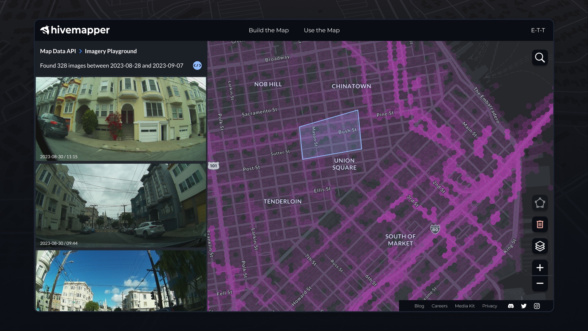
Hivemapper’s APIs can enhance your app’s navigational capabilities with high-quality, up-to-date road imagery and features.
Ensuring that users of navigation apps have access to the latest and most accurate data is a considerable challenge for developers. The expectation of updated maps requires a robust system for gathering and verifying vast amounts of information.
Hivemapper’s fresh street-level imagery, from which Map AI extracts features and insights, offers app developers a competitive edge. Our Map Image API enables developers to directly ingest standardized imagery into their systems, while our Map Features API provides a detailed inventory of road elements, such as stop signs, speed limits, and traffic lights.
Visit our product page and contact sales to learn more. To get started, generate an API key. By integrating our Map Image API and Map Features API, developers can powerfully enhance their navigation apps in a variety of ways.

Freshness
Conventional mapping struggles to keep pace with the real world. New roads, closures, and sign changes are constant occurrences. Navigation apps rely on fast, reliable access to current map data, but maintaining an up-to-date internal map database requires immense resources. Hivemapper’s crowdsourced data pipeline has a constant stream of updated road imagery. Integrating this fresh data eliminates the need for navigation apps to update their own map databases. Users benefit from the most current road conditions, which is particularly valuable in areas where construction or rapid development is common.
Dynamic Road Features
Hivemapper’s Map AI leverages computer vision, geospatial processing, and validation from contributors to deliver a wealth of map details. This granular data equips navigation apps with up-to-date data and intelligence to provide enhanced route guidance and accurate speed limit information, improving the overall navigation experience for the user.
Coverage
Conventional mapping services struggle to achieve and maintain comprehensive geographic coverage. Hivemapper’s global crowdsourced network can expand into areas lacking coverage far quicker and more reliably than a corporate mapping fleet. Our Map Image and Map Features APIs grant access to imagery and features from new regions as soon as they are collected and processed, allowing navigation apps to efficiently expand their coverage into new markets without the need for extensive groundwork to collect local data.
Accuracy
Navigation depends on precision. Even slight distortions in map data can throw off route calculations, misleading and frustrating users. Hivemapper’s road imagery adheres to tight standards, with map features positioned via 3D reconstruction and audited for accuracy. This high-fidelity data enhances routing performance.
Scalable Integration
As navigation apps grow, so does their need for scalable solutions. Hivemapper’s APIs are built to support businesses as they scale, allowing for the integration of new data without a loss in performance. Developers can seamlessly incorporate Hivemapper’s data into their apps without extensive backend overhauls, speeding the time-to-market for new features. The APIs also allow for the customization of data usage, meaning that navigation apps can tailor the data to fit the specific needs and preferences of their user base.
Hivemapper’s Map Image API and Map Features API provide access to consistent, high-quality, and detailed map data that can significantly boost the efficiency, coverage, and accuracy of navigation apps. By building the world’s freshest map, Hivemapper helps ensure that developers and users alike are always one step ahead.**
Follow us on X or Try Bee Maps for Free.

