The Network is Buzzing
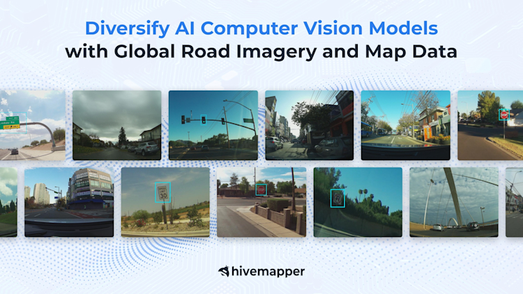
Diversify AI Computer Vision Models with Global Road Imagery and Map Data

Hivemapper’s extensive road imagery and detailed map data can help train robust and adaptable computer vision systems.
Training AI vision and machine-learning models to interpret and react to the world’s roads requires vast amounts of visual data. But available training data is often limited in scope, focusing on specific regions or conditions. This leaves models brittle, causing their performance to break down when they face environments and circumstances that deviate from their training — underscoring the need for diverse mapping data to create reliable systems.
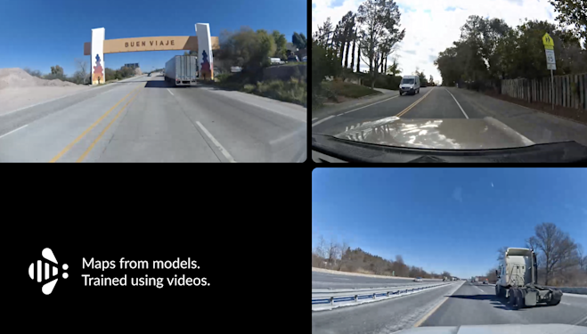
Hivemapper’s standardized, crowdsourced road imagery provides a deep dataset for training adaptable AI models. The network has mapped some 90 million total road kilometers across more than 90 countries, encompassing over 3 billion individual street-level images. Collected by a global network of dashcam-equipped drivers across urban, suburban, and rural regions, this imagery spans different geographies and weather conditions, reflecting varied on-road complexities.
Developers can use our Map Image API to conveniently integrate this dynamic imagery to train their systems, exposing them to a broad spectrum of roadways and environmental settings. Our Map Features API provides extracted objects like road signs and traffic signals across varied regions, offering further training data. By being fed a stream of constantly updated imagery and road features, AI and ML models will be better positioned to translate inputs into actionable insights.
Visit our product page and contact sales to learn more. To get started, generate an API key.
Geographic Diversity
Computer vision models thrive on data, but they often lack sufficient variety. Systems trained solely on select regions can have difficulty generalizing, which leaves them unprepared for real-world deployments. Urban downtowns have different visuals than suburban subdivisions or rural routes. Hivemapper’s reach can introduce many new scenarios to training datasets, incorporating wide variance and enabling models to operate across different locations.
Road Feature Variations
Just as languages vary across different cultures and geographies, so do road signs. Even within similar areas, subtle differences in signage and road markings can trip up models that lack multi-regional examples. Traffic lights can also differ in look and orientation. Hivemapper’s data includes classified road features from different countries, providing a visual dictionary for AI to interpret, enabling developers to train models that are adaptable to international deployments.
Weather and Lighting
Beyond geographic diversity, Hivemapper offers a range of imagery across varied weather and lighting conditions, with imagery collected from shortly after sunrise to shortly before sunset. Models learn to handle glare and shadows, as well as visibility during overcast conditions, rain, and fog. Sunny days in Phoenix present different challenges than snowy conditions in Oslo. Computer vision systems need exposure to these variances to prevent fragility and operate reliably year-round. Models trained on Hivemapper’s fresh data repository learn to take lighting, precipitation, and other environmental factors in stride, becoming more versatile.
Preparing for Unpredictability
Diverse visual mapping data can also be invaluable in identifying edge cases and uncommon scenarios. Models trained on controlled datasets can falter when faced with anomalous or unexpected circumstances. Hivemapper’s continuous crowdsourced data can help by surfacing unusual examples, like partial sign occlusion and other irregularities. These cases help developers optimize systems against vulnerabilities while providing the inputs models need to enhance their predictive capabilities and better manage the unexpected.
Together, these advantages enable deeper and more reliable model training. But Hivemapper’s greatest asset is its continuous growth. The variety and distribution of our coverage is always expanding and being updated. This allows developers to refresh training data over time, keeping pace with evolving conditions. Rather than training models on static datasets, Hivemapper provides a data stream that reflects the actual state of roadways.
Diverse data is essential for building robust computer vision systems. Hivemapper offers a dynamic dataset for training and deploying vision systems that reliably interpret our complex roadways. Developers can conveniently integrate this vast, crowdsourced image repository and cover a range of different geographic, weather, and lighting scenarios. Combined with extracted road objects and features, our visual data empowers the training of highly adaptable AI models that are prepared for the unpredictability of the real world.**


