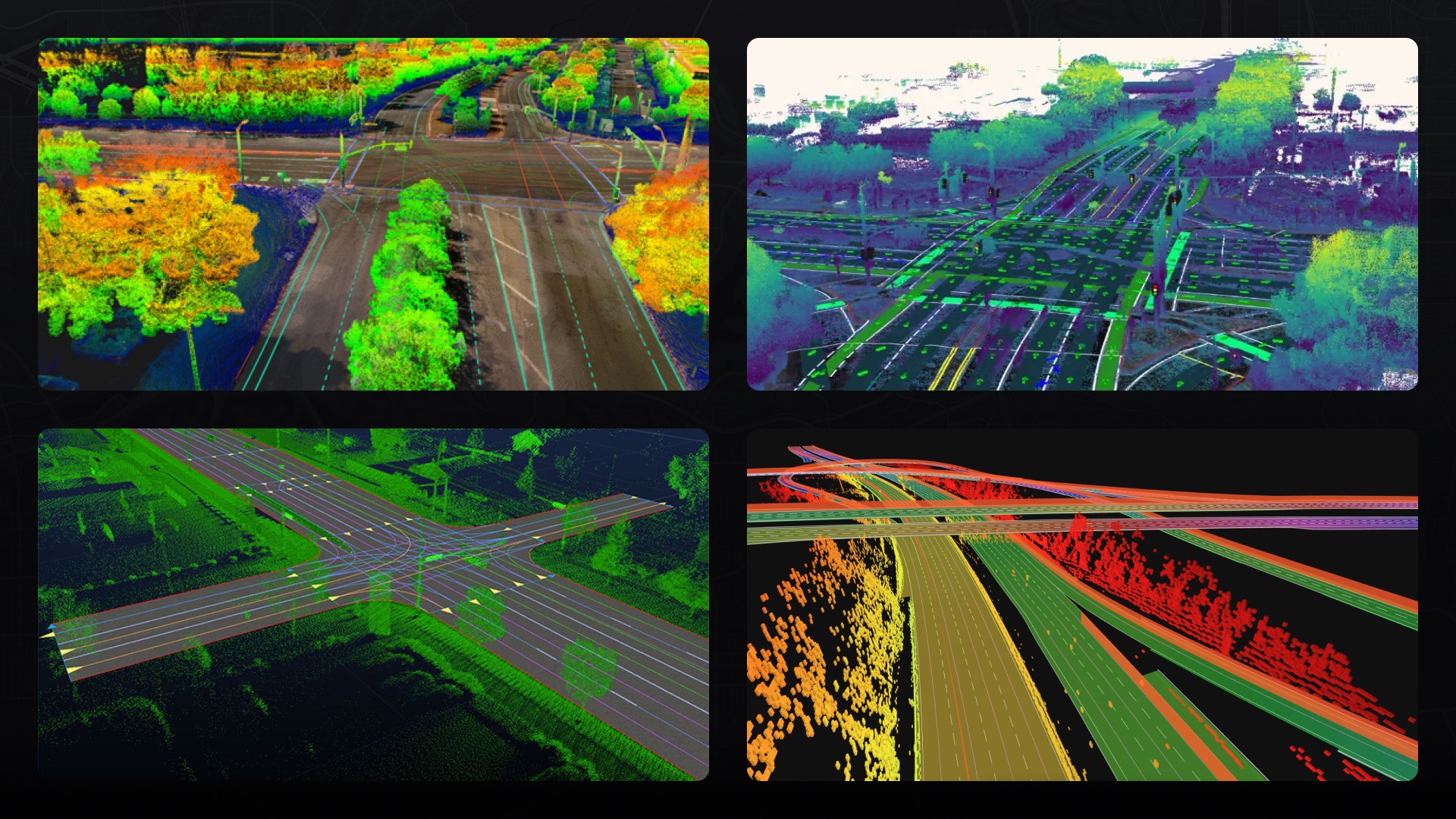
The network’s imagery is continuously updated, equipping autonomous vehicles with fresh data for accurate navigation.
Autonomous vehicles rely on highly detailed digital maps to navigate and understand their environment. These maps extend beyond what a human would see on a typical navigation app, combining street layouts with rich information about road features that are essential for driving.
Hivemapper’s crowdsourced mapping can help accelerate the rollout of autonomous vehicles — an industry that could generate $300 billion to $400 billion in revenue by 2035. Everyday drivers using specialized dashcams capture standardized street-level imagery from which highly a detailed map is created using Map AI. The imagery and map are continuously updated, ensuring safer and more efficient navigation for self-driving cars and trucks.
AV developers can use the Map Image API to ingest large amounts of street-level imagery to update maps for their vehicles. They can use the Map Features API to integrate map features processed by the network’s Map AI, including speed signs, turn restriction signs, highway exit signs, stop signs, and vehicle traffic lights.
Our Bursts feature enables them to incentivize map contributors to target specific locations that are in need of updates or monitoring. Scout, our location monitoring tool, can be used to set specific locations to be monitored for changes and new imagery. Visit our product page and contact sales to learn more. To get started, generate an API key.
Localization and Navigation
When an autonomous vehicle enters a new area, it localizes itself by comparing sensor data to its map database. Using cameras and LIDAR, it matches detected landmarks like traffic lights and street signs to what’s stored in the map. This identifies the vehicle’s precise location.
With its position determined, the vehicle can leverage the map’s encoded details as it makes driving decisions. Speed limits, lane markings, intersections —all are digitally modeled. The vehicle continuously cross-references sensor data against the map as it drives, allowing it to “see” all necessary features.

For instance, when the vehicle approaches an intersection, it consults a digital map like the above examples to determine the exact location of lane markings, traffic lights, and street signs. The map also provides right-of-way rules so that the vehicle understands who has priority. This depth of contextual information surpasses what raw sensor data can offer.
Every time those features change, the map needs to change too. Hivemapper prioritizes accuracy and freshness, reliably delivering information that’s essential to autonomous vehicles.
Dynamic Map Data
Hivemapper’s crowdsourced mapping can greatly enhance autonomous vehicle capabilities. The network efficiently provides comprehensive digital maps of regional areas tailored to support autonomous navigation and machine learning. It incorporates human-level understanding of road features, rules, and limitations, allowing self-driving vehicles to seamlessly integrate map data with real-time sensor feedback.
Data-Driven Insights
Given the potential of autonomous vehicles to reduce accidents and improve mobility for various demographics, such as the elderly, high-quality mapping data supports increased safety. Vehicles can handle intricate city terrains confidently and competently, leveraging the map for both real-time and strategic planning.
With Hivemapper contributors covering and updating regions continuously, autonomous developers can access a wealth of virtual testing environments. Unbound by physical test fleets, they can validate driving algorithms across a growing collection of mapped locations with extensive variation. This aligns with the industry’s shift toward data-driven development and verification, emphasizing the importance of real-world inputs for rigorous testing.
Scalability also improves dramatically. Crowdsourced mapping enables autonomous vehicles to launch in new locations with minimal setup. Gone are the days of manually charting extensive street networks beforehand. With Hivemapper’s ability to provide fresh road coverage virtually anywhere, autonomous services can efficiently expand nationwide and globally.
The Autonomous Future
The rapid progression of autonomous vehicles highlights the need for accurate and relevant mapping data. By harnessing collective contributions, Hivemapper provides a robust solution to the challenges of mapping dynamic environments, bolstering the operations of self-driving cars with enhanced efficiency.
The transportation industry is evolving, and so too must the tools that enable its growth. As we journey into this exciting era, Hivemapper helps ensure that every turn, stop, and decision made by autonomous vehicles is well-informed and safe.**
Follow us on X or Try Bee Maps for Free.

