The Latest Buzz
Hivemapper’s Automated Map AI Pipeline Generates Detailed Road Features

How computer vision, geospatial processing, and crowdsourced validation transforms raw imagery into high-fidelity maps.
Raw map data, no matter how vast, remains just a jumble of information until you give it meaning and structure. While collecting high-quality imagery is an important first step, converting those pixels into an accurate world map requires solving intricacies far beyond basic detection.
As the Hivemapper Network approaches its first anniversary, we’re proud to announce that our Map AI pipeline is fully operational and capable of generating detailed map features from raw imagery without human intervention.
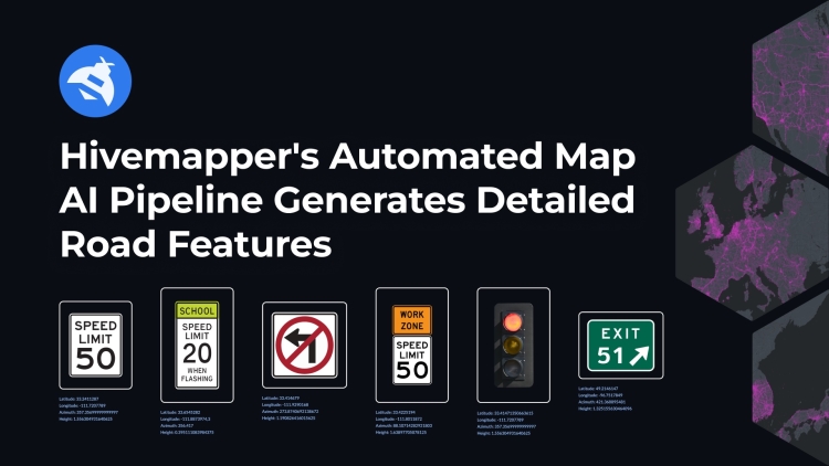
Object detection is just the tip of the iceberg for building a useful, dynamic map from standardized street-level imagery. Take street signs, for example. Detecting a street sign doesn’t achieve anything useful unless you can also identify the attributes that give it meaning. Is it a speed limit sign? If so, what is the specified speed limit? Where precisely is the sign located? Which way is it facing? Is it a unique speed limit sign, or another sighting of a sign that has already been spotted?
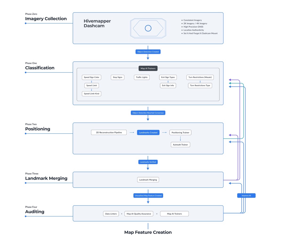
Hivemapper’s Map AI leverages computer vision, geospatial processing, and validation from contributors playing AI Trainer games to do more than just detect. Our end-to-end pipeline classifies, positions, merges, and audits objects to produce a richly detailed, high-fidelity map.
Use our Map Features API to ingest features processed by the network’s Map AI, including speed signs, turn restriction signs, highway exit signs, stop signs, and vehicle traffic lights. Use our Map Image API to integrate high-resolution road imagery. Visit our product page and contact sales to learn more. To get started, generate an API key.
Collection/Detection
It starts with imagery collected worldwide by our network of dashcam operators. As this raw data streams in, the Map AI detects road features like signs, lights, and lane markings. When the Map AI is uncertain about its output, Hivemapper’s AI Trainer games allow contributors to validate them and earn HONEY rewards for their input.
Classification
Once detected, each object undergoes detailed classification based on various attributes (type, color, info, etc.). The Map AI handles this process automatically, with AI trainers stepping in to refine outputs when they require additional clarity.
Positioning/Azimuth
Next, the Map AI uses camera GPS, image processing, and 3D reconstruction to precisely position each object in geographic space and determine its orientation. The Map AI specifies, for example, that there is a speed sign at a particular location, facing a certain direction. The resulting positioned objects are called Landmarks.
Merging
To filter out duplicates and prevent redundancy, Landmarks are automatically merged into unified Map Features that represent real-world map objects. Again, human validation provides training for the Map AI when it isn’t 100% confident.
Auditing
The final stage toward realizing full automation involved the recent integration of data linters, which automate much of the auditing process. Anomalies and errors are detected programmatically, reducing the need for manual reviews. Critical attributes like speed limits still get additional reviews to guarantee precision.
Continuous Improvement
Hivemapper’s end-to-end automation supports the production of high-fidelity maps, enabling the network to continue scaling globally. Going forward, our priority will be an ongoing focus to optimize positioning for maximum accuracy.
As we refine our systems, the efficiency and scalability of our mapping process will support the creation of fresh map data worldwide. We’re building the most accurate and up-to-date map possible by combining crowdsourced contributions with artificial intelligence. The end-to-end automation of our Map AI pipeline is an exciting milestone on our journey toward that goal.
__
Follow us on X (Twitter) and join the community on Discord.
Share Post


